
Bestand:Norfolk UK relief location map.jpg

Grootte van deze voorvertoning: 800 × 497 pixels. Andere resoluties: 320 × 199 pixels | 640 × 398 pixels | 1.024 × 636 pixels | 1.280 × 795 pixels | 1.999 × 1.242 pixels.
Oorspronkelijk bestand (1.999 × 1.242 pixels, bestandsgrootte: 229 kB, MIME-type: image/jpeg)
| Dit is een bestand van Wikimedia Commons. Onderstaande beschrijving komt van de beschrijving van het bestand daar. |
| Beschrijving |
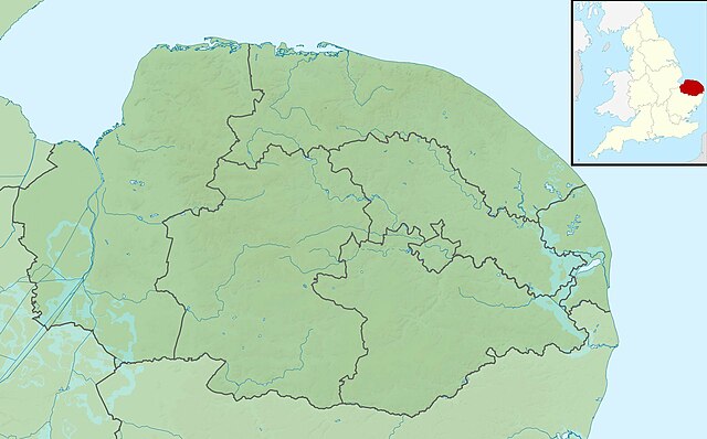
Relief map of Norfolk, UK. Equirectangular map projection on WGS 84 datum, with N/S stretched 160% Geographic limits:
|
| Datum | |
| Bron |
|
| Auteur | Nilfanion, created using Ordnance Survey data |
| Toestemming (Hergebruik van dit bestand) |
Dit bestand is gelicenseerd onder de Creative Commons-licentie Naamsvermelding-Gelijk delen 3.0 Unported Naamsvermelding: Contains Ordnance Survey data © Crown copyright and database right
|
| Andere versies | File:Norfolk UK district map (blank).svg - Blank map |
.svg)
Bestandsgeschiedenis
Klik op een datum/tijd om het bestand te zien zoals het destijds was.
| Datum/tijd | Miniatuur | Afmetingen | Gebruiker | Opmerking | |
|---|---|---|---|---|---|
| huidige versie | 29 nov 2011 03:46 | | 1.999 × 1.242 (229 kB) | Nilfanion | {{Information |Description=Relief map of Norfolk, UK. Equirectangular map projection on WGS 84 datum, with N/S stretched 160% Geographic limits: *West: 0.12E *East: 2.00E *North: 53.05N *South: 52.32N |Source=[[w:Ordnance Survey|Ordnance S |
Bestandsgebruik
Dit bestand wordt op de volgende pagina gebruikt:
Globaal bestandsgebruik
De volgende andere wiki's gebruiken dit bestand:
- Gebruikt op ar.wikipedia.org
- Gebruikt op bg.wikipedia.org
- Gebruikt op ceb.wikipedia.org
- Gebruikt op cs.wikipedia.org
- Gebruikt op en.wikipedia.org
- Malthouse Broad
- Hoveton Great Broad
- Crome's Broad
- Salhouse Broad
- Holkham National Nature Reserve
- River Ant
- River Yare
- River Thurne
- River Chet
- River Wensum
- Titchwell Marsh
- Sandringham House
- River Burn, Norfolk
- Filby Broad
- Beacon Hill, Norfolk
- River Stiffkey
- River Tas
- Blakeney Point
- Horsey Mere
- River Glaven
- Heacham River
- Gaywood River
- River Tiffey
- River Thet
- Buxton Watermill
- River Tud
- River Cong (Norfolk)
- River Mun
- River Hun
- River Ingol
- Beeston Beck (Norfolk)
- River Tat
- River Ainse (or Eyn)
- Scarrow Beck
- River Hor
- Gur Beck
- Hagon Beck
- Panford Beck
- Penny Spot Beck
Globaal gebruik van dit bestand bekijken.