
Bestand:Nottinghamshire UK relief location map.jpg

Grootte van deze voorvertoning: 473 × 600 pixels. Andere resoluties: 189 × 240 pixels | 378 × 480 pixels | 605 × 768 pixels | 807 × 1.024 pixels | 2.002 × 2.539 pixels.
Oorspronkelijk bestand (2.002 × 2.539 pixels, bestandsgrootte: 456 kB, MIME-type: image/jpeg)
| Dit is een bestand van Wikimedia Commons. Onderstaande beschrijving komt van de beschrijving van het bestand daar. |
| Beschrijving |
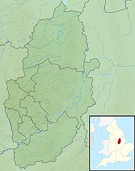
Relief map of Nottinghamshire, UK. Equirectangular map projection on WGS 84 datum, with N/S stretched 165% Geographic limits:
|
| Datum | |
| Bron |
|
| Auteur | Nilfanion, created using Ordnance Survey data |
| Toestemming (Hergebruik van dit bestand) |
Dit bestand is gelicenseerd onder de Creative Commons-licentie Naamsvermelding-Gelijk delen 3.0 Unported Naamsvermelding: Contains Ordnance Survey data © Crown copyright and database right
|
| Andere versies | File:Nottinghamshire UK district map (blank).svg - Blank map |
.svg)
Bestandsgeschiedenis
Klik op een datum/tijd om het bestand te zien zoals het destijds was.
| Datum/tijd | Miniatuur | Afmetingen | Gebruiker | Opmerking | |
|---|---|---|---|---|---|
| huidige versie | 29 nov 2011 03:50 | | 2.002 × 2.539 (456 kB) | Nilfanion | {{Information |Description=Relief map of Nottinghamshire, UK. Equirectangular map projection on WGS 84 datum, with N/S stretched 165% Geographic limits: *West: 1.37W *East: 0.42W *North: 53.51N *South: 52.78N |Source=[[w:Ordnance S |
Bestandsgebruik
Dit bestand wordt op de volgende pagina gebruikt:
Globaal bestandsgebruik
De volgende andere wiki's gebruiken dit bestand:
- Gebruikt op ar.wikipedia.org
- Gebruikt op bg.wikipedia.org
- Gebruikt op ceb.wikipedia.org
- Gebruikt op en.wikipedia.org
- River Leen
- White Ladies Priory
- Relief of Newark
- Hemlock Stone
- Silverhill, Nottinghamshire
- Sutton Bonington weather station
- Kelham Hall
- River Smite
- Boots Factory Site
- Module:Location map/data/United Kingdom Nottinghamshire
- Module:Location map/data/Nottinghamshire
- Module:Location map/data/United Kingdom Nottinghamshire/doc
- Nottingham Weather Centre
- Gebruikt op es.wikipedia.org
- Gebruikt op fr.wikipedia.org
- Gebruikt op ig.wikipedia.org
- Gebruikt op ja.wikipedia.org
- Gebruikt op kn.wikipedia.org
- Gebruikt op mk.wikipedia.org
- Gebruikt op os.wikipedia.org
- Gebruikt op pl.wikipedia.org
- Gebruikt op pl.wikibooks.org
- Gebruikt op ru.wikipedia.org
- Gebruikt op sco.wikipedia.org
- Gebruikt op simple.wikipedia.org
Globaal gebruik van dit bestand bekijken.