
Bestand:Obcine Slovenija 2006.svg

Afmetingen van deze voorvertoning van het type PNG van dit SVG-bestand: 800 × 522 pixels Andere resoluties: 320 × 209 pixels | 640 × 418 pixels | 1.024 × 668 pixels | 1.280 × 835 pixels | 2.560 × 1.670 pixels | 2.613 × 1.705 pixels.
Oorspronkelijk bestand (SVG-bestand, nominaal 2.613 × 1.705 pixels, bestandsgrootte: 2,31 MB)
| Dit is een bestand van Wikimedia Commons. Onderstaande beschrijving komt van de beschrijving van het bestand daar. |
Beschrijving
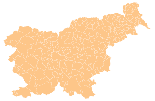
| Beschrijving | Map of the municipalities (občine) of the Republic of Slovenia, as since May 2006 (210 units). |
| Datum | |
| Bron | Source of the public data is GURS (Geodetska uprava Republike Slovenije or Surveying and Mapping Authority of the Republic of Slovenia). Converted from Shapefile to SVG with shp2svg and prepared for Wikipedia by romanm (talk). |
| Auteur | See above. |
| Toestemming (Hergebruik van dit bestand) |
See Pogoji uporabe (in Slovene) and Terms and conditions (English). According to price list, which states cost 0€ for using free-of-charge published data on municipalities even for commercial purposes(!), I consider the data to be in public domain. I also hereby grant my work on this file to be in public domain. |
| Andere versies |
|

Licentie
| Ik, de auteursrechthebbende van dit werk, geef dit werk vrij in het publieke domein. Dit is wereldwijd van toepassing. In sommige landen is dit wettelijk niet mogelijk; in die gevallen geldt: Ik sta iedereen toe dit werk voor eender welk doel te gebruiken, zonder enige voorwaarden, tenzij zulke voorwaarden door de wet worden voorgeschreven. |
Bestandsgeschiedenis
Klik op een datum/tijd om het bestand te zien zoals het destijds was.
| Datum/tijd | Miniatuur | Afmetingen | Gebruiker | Opmerking | |
|---|---|---|---|---|---|
| huidige versie | 13 apr 2012 18:19 | | 2.613 × 1.705 (2,31 MB) | Martin Kraft | size and display problem fixed reduced number of points |
| 3 nov 2008 23:32 |  | 2.613 × 1.705 (2,36 MB) | Romanm | fixed aspect ratio Category:Maps of administrative units of Slovenia | |
| 3 nov 2008 23:21 |  | 512 × 334 (2,36 MB) | Romanm | {{Information |Description=Map of the municipalities (''občine'') of the Republic of Slovenia, as since May 2006 (211 units). |Source=Source of [http://www.gu.gov.si/si/delovnapodrocja_gu/podatki_gu/brezplani_podatki/brezplani_podatki_obine/ the public d |
Bestandsgebruik
Geen enkele pagina gebruikt dit bestand.
Globaal bestandsgebruik
De volgende andere wiki's gebruiken dit bestand:
- Gebruikt op ast.wikipedia.org
- Gebruikt op azb.wikipedia.org
- Gebruikt op cs.wikipedia.org
- Gebruikt op de.wikipedia.org
- Gebruikt op eu.wikipedia.org
- Gebruikt op kbd.wikipedia.org
- Gebruikt op la.wikipedia.org
- Gebruikt op sco.wikipedia.org
- Gebruikt op sl.wikipedia.org
- Gebruikt op vi.wikipedia.org