
Bestand:PEFO park map 2006 large.png
Grootte van deze voorvertoning: 485 × 600 pixels. Andere resoluties: 194 × 240 pixels | 388 × 480 pixels | 621 × 768 pixels | 828 × 1.024 pixels | 1.800 × 2.225 pixels.
Oorspronkelijk bestand (1.800 × 2.225 pixels, bestandsgrootte: 1,69 MB, MIME-type: image/png)
| Dit is een bestand van Wikimedia Commons. Onderstaande beschrijving komt van de beschrijving van het bestand daar. |
Beschrijving
| Beschrijving |
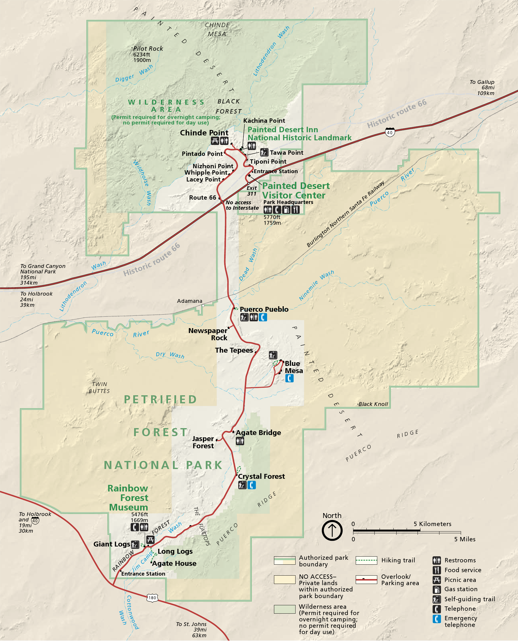
English: Map of Petrified Forest National Park — in northeastern Arizona, United States.
|
| Datum | |
| Bron | official park map |
| Auteur | National Park Service; converted from PDF to PNG format by User:Finetooth using GNU Image Manipulation Program (GIMP) software |
Licentie
| Dit beeld- of mediabestand bevat materiaal gebaseerd op een werk van een National Park Service medewerker, gemaakt als onderdeel van de officiële taken van die persoon. Als een werk van de Amerikaanse federale overheid, bevindt dergelijk werk zich in het publieke domein in de Verenigde Staten. Zie de NPS website en NPS copyright policy voor meer informatie. |
Bestandsgeschiedenis
Klik op een datum/tijd om het bestand te zien zoals het destijds was.
| Datum/tijd | Miniatuur | Afmetingen | Gebruiker | Opmerking | |
|---|---|---|---|---|---|
| huidige versie | 28 okt 2010 22:41 | | 1.800 × 2.225 (1,69 MB) | Finetooth | {{Information |Description={{en|1=Map of Petrified Forest National Park in northeastern Arizona, United States}} |Source=National Park Service [http://www.nps.gov/pefo/planyourvisit/maps.htm maps] |Au |
Bestandsgebruik
Dit bestand wordt op de volgende pagina gebruikt:
Globaal bestandsgebruik
De volgende andere wiki's gebruiken dit bestand:
- Gebruikt op da.wikipedia.org
- Gebruikt op de.wikipedia.org
- Gebruikt op en.wikipedia.org
- Gebruikt op eu.wikipedia.org
- Gebruikt op he.wikipedia.org
- Gebruikt op pl.wikipedia.org
- Gebruikt op pt.wikipedia.org
- Gebruikt op tr.wikipedia.org
- Gebruikt op vi.wikipedia.org