
Bestand:Pinus ponderosa subspecies range map.png
Grootte van deze voorvertoning: 489 × 599 pixels. Andere resoluties: 196 × 240 pixels | 609 × 746 pixels.
Oorspronkelijk bestand (609 × 746 pixels, bestandsgrootte: 77 kB, MIME-type: image/png)
| Dit is een bestand van Wikimedia Commons. Onderstaande beschrijving komt van de beschrijving van het bestand daar. |
| Beschrijving |
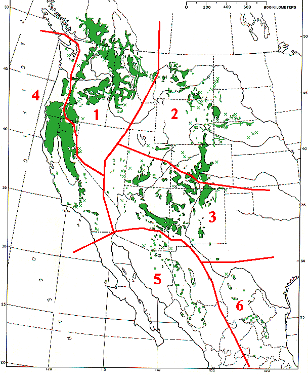
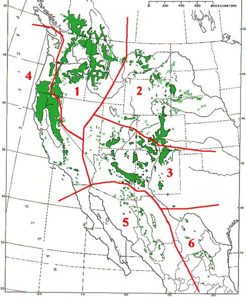
Range map of Pinus ponderosa and Pinus arizonica
|
|||
| Datum | ||||
| Bron | Base map (black outlines & green range map) is from USDA Forest Service Misc,.Publ. 991 (public domain-USGov); red delineation is my work, which I release into public domain | |||
| Auteur | MPF | |||
| Toestemming (Hergebruik van dit bestand) |
|
Bestandsgeschiedenis
Klik op een datum/tijd om het bestand te zien zoals het destijds was.
| Datum/tijd | Miniatuur | Afmetingen | Gebruiker | Opmerking | |
|---|---|---|---|---|---|
| huidige versie | 7 dec 2009 16:09 | | 609 × 746 (77 kB) | MPF | {{Information |Description=Range map of ''Pinus ponderosa'' and ''Pinus arizonica'' # ''Pinus ponderosa'' subsp. ''ponderosa'' - North Plateau Ponderosa Pine # ''Pinus ponderosa'' subsp. ''scopulorum'' - Rocky Mts Ponderosa Pine # ''Pinus ponderos |
Bestandsgebruik
Dit bestand wordt op de volgende pagina gebruikt:
Globaal bestandsgebruik
De volgende andere wiki's gebruiken dit bestand:
- Gebruikt op arz.wikipedia.org
- Gebruikt op ca.wikipedia.org
- Gebruikt op cs.wikipedia.org
- Gebruikt op el.wikipedia.org
- Gebruikt op es.wikipedia.org
- Gebruikt op id.wikipedia.org
- Gebruikt op pl.wikipedia.org
- Gebruikt op pt.wikipedia.org
- Gebruikt op sv.wikipedia.org
- Gebruikt op tr.wikipedia.org
- Gebruikt op uk.wikipedia.org
- Gebruikt op www.wikidata.org