
Bestand:Roca Partida Karte map.png
Geen hogere resolutie beschikbaar.
Roca_Partida_Karte_map.png (500 × 500 pixels, bestandsgrootte: 37 kB, MIME-type: image/png)
| Dit is een bestand van Wikimedia Commons. Onderstaande beschrijving komt van de beschrijving van het bestand daar. |
Beschrijving
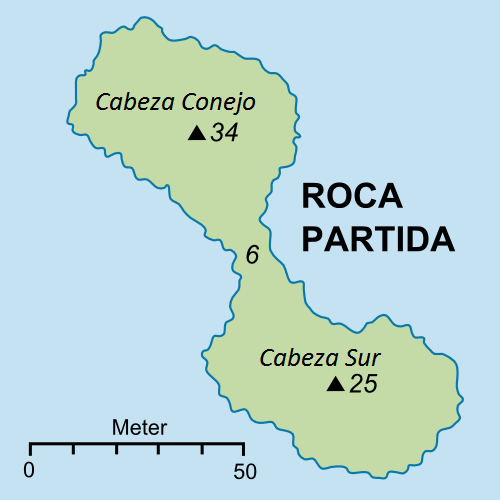
| Beschrijving | Karte der unbewohnten Felsinsel Roca Partida im Pazifik |
| Datum | |
| Bron |
"own work", used: |
| Auteur | Lencer |

|
Deze kaart is gemaakt of verbeterd in de Duitse Kartenwerkstatt (Map Lab). Je kunt ook zelf kaarten ter verbetering voorstellen.
|
Licentie
Dit bestand is gelicenseerd onder de Creative Commons-licentie Naamsvermelding-Gelijk delen 3.0 Unported
- De gebruiker mag:
- Delen – het werk kopiëren, verspreiden en doorgeven
- Remixen – afgeleide werken maken
- Onder de volgende voorwaarden:
- naamsvermelding – U moet op een gepaste manier aan naamsvermelding doen, een link naar de licentie geven, en aangeven of er wijzigingen in het werk zijn aangebracht. U mag dit op elke redelijke manier doen, maar niet zodanig dat de indruk wordt gewekt dat de licentiegever instemt met uw werk of uw gebruik van zijn werk.
- Gelijk delen – Als u het werk heeft geremixt, veranderd, of erop heeft voortgebouwd, moet u het gewijzigde materiaal verspreiden onder dezelfde licentie als het oorspronkelijke werk, of een daarmee compatibele licentie.
Bestandsgeschiedenis
Klik op een datum/tijd om het bestand te zien zoals het destijds was.
| Datum/tijd | Miniatuur | Afmetingen | Gebruiker | Opmerking | |
|---|---|---|---|---|---|
| huidige versie | 27 dec 2017 22:20 | | 500 × 500 (37 kB) | Ratzer | mountain names according to http://mexicodeultramar.blogspot.de/2015/02/dia-12-domingo-24-04-roca-partida.html |
| 7 jan 2011 12:27 |  | 500 × 500 (35 kB) | Lencer | {{Information |Description= Karte der unbewohnten Felsinsel Roca Partida im Pazifik |Source="own work", used: * [http://solmarv.com/graphics/RocaPartidaL.gif http://solmarv.com/graphics/RocaPartidaL.gif] |Date=2011-01 |Author=[[User:L |
Bestandsgebruik
Dit bestand wordt op de volgende pagina gebruikt:
Globaal bestandsgebruik
De volgende andere wiki's gebruiken dit bestand:
- Gebruikt op bg.wikipedia.org
- Gebruikt op de.wikipedia.org
- Gebruikt op es.wikipedia.org
- Gebruikt op fi.wikipedia.org
- Gebruikt op gl.wikipedia.org
- Gebruikt op it.wikipedia.org
- Gebruikt op ja.wikipedia.org
- Gebruikt op pt.wikipedia.org
- Gebruikt op sr.wikipedia.org
- Gebruikt op sv.wikipedia.org
- Gebruikt op zh.wikipedia.org