
Bestand:Sanborn A-Y-P map.jpg
Grootte van deze voorvertoning: 473 × 600 pixels. Andere resoluties: 189 × 240 pixels | 378 × 480 pixels | 605 × 768 pixels | 1.200 × 1.522 pixels.
Oorspronkelijk bestand (1.200 × 1.522 pixels, bestandsgrootte: 390 kB, MIME-type: image/jpeg)
| Dit is een bestand van Wikimedia Commons. Onderstaande beschrijving komt van de beschrijving van het bestand daar. |
Beschrijving
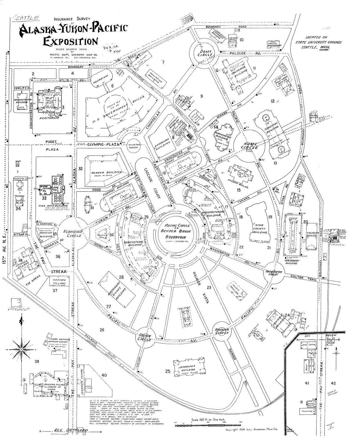
| Beschrijving | Map of the Alaska-Yukon-Pacific Exposition (the current University of Washington campus): Insurance Survey of Alaska-Yukon-Pacific Exposition |
| Datum | |
| Bron | Digital Sanborn Maps 1867-1970 |
| Auteur | Pacific Dept Sanborn Map Company (San Francisco) |
| Toestemming (Hergebruik van dit bestand) |
PD-US |
Licentie
Dit mediabestand is in het publiek domein in de Verenigde Staten van Amerika. Dit geldt voor werken uit de VS waarvan de copyright is verlopen, meestal omdat de eerste publicatie ervan verscheen voor 1 januari 1929. Zie ook deze pagina voor verdere uitleg
|
 | |
 |
Let op! Dit bestand hoeft niet in het publiek domein te zijn buiten de VS (dit geldt voor Canada, China (excl. Hong Kong, Macao of Taiwan), Duitsland, Mexico en Zwitserland). De auteur en het jaar van publicatie zijn essentiële informatie en moeten zijn vastgesteld. Zie ook Wikipedia:Public domain en Wikipedia:Copyrights voor meer informatie.
|
Bestandsgeschiedenis
Klik op een datum/tijd om het bestand te zien zoals het destijds was.
| Datum/tijd | Miniatuur | Afmetingen | Gebruiker | Opmerking | |
|---|---|---|---|---|---|
| huidige versie | 3 okt 2008 22:26 | | 1.200 × 1.522 (390 kB) | Jmabel | == Summary == {{Information |Description=Map of the Alaska-Yukon-Pacific Exposition (the current University of Washington campus): Insurance Survey of Alaska-Yukon-Pacific Exposition |Source=Digital Sanborn Maps 1867-1970 |Date=March 1909 |Author=Pacific |
Bestandsgebruik
Dit bestand wordt op de volgende pagina gebruikt:
Globaal bestandsgebruik
De volgende andere wiki's gebruiken dit bestand:
- Gebruikt op en.wikipedia.org
- Gebruikt op no.wikipedia.org
- Gebruikt op www.wikidata.org