
Bestand:Santa Cruz topographic map-en.png
Grootte van deze voorvertoning: 596 × 600 pixels. Andere resoluties: 239 × 240 pixels | 477 × 480 pixels | 763 × 768 pixels | 1.018 × 1.024 pixels | 2.036 × 2.048 pixels | 3.189 × 3.208 pixels.
Oorspronkelijk bestand (3.189 × 3.208 pixels, bestandsgrootte: 2,12 MB, MIME-type: image/png)
| Dit is een bestand van Wikimedia Commons. Onderstaande beschrijving komt van de beschrijving van het bestand daar. |
| Beschrijving |
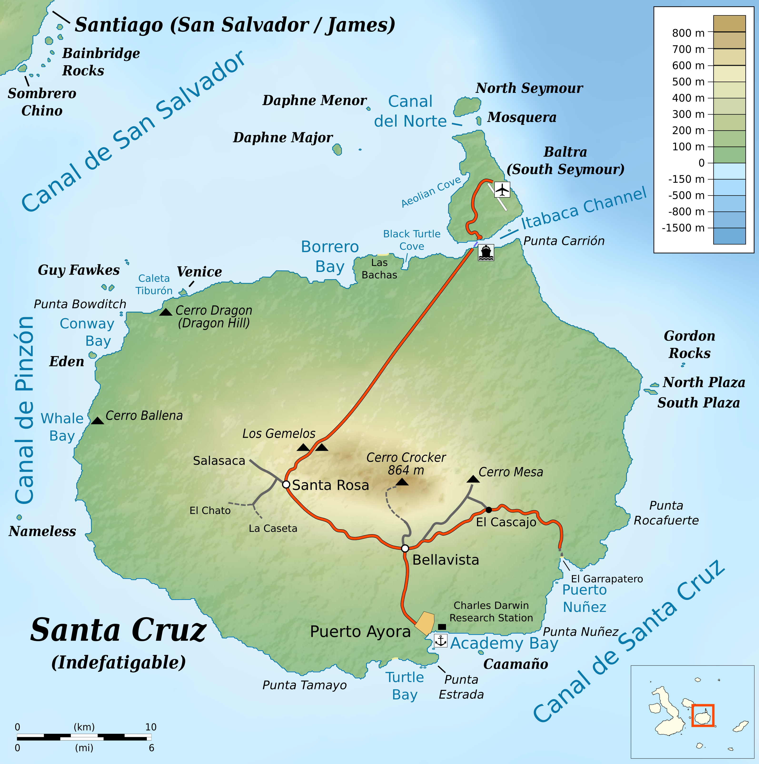
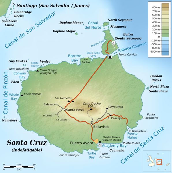
English: Topographic map of en:Santa Cruz Island (Galápagos)
cylindrical equidistant projection, central meridian -90° 30', standard parallel 0° |
|||||||
| Datum | ||||||||
| Bron |
own work, using: |
|||||||
| Auteur | Bamse | |||||||
| Toestemming (Hergebruik van dit bestand) |
|
|||||||
| Andere versies |
|


Bestandsgeschiedenis
Klik op een datum/tijd om het bestand te zien zoals het destijds was.
| Datum/tijd | Miniatuur | Afmetingen | Gebruiker | Opmerking | |
|---|---|---|---|---|---|
| huidige versie | 2 jun 2016 23:02 | | 3.189 × 3.208 (2,12 MB) | Bamse | fix airport icon |
| 2 jun 2016 14:39 |  | 3.189 × 3.208 (2,12 MB) | Bamse | {{Information |Description ={{en|1=Topographic map of en:Santa Cruz Island (Galápagos)}} cylindrical equidistant projection, central meridian -90° 30', standard parallel 0° |Source =own work, using: * [[:File:Ecuador Galápagos Islan... |
Bestandsgebruik
Dit bestand wordt op de volgende pagina gebruikt:
Globaal bestandsgebruik
De volgende andere wiki's gebruiken dit bestand:
- Gebruikt op fr.wikipedia.org