
Bestand:Scotland Map (Firth of Lorn Detail) Loch Linnhe.png
Geen hogere resolutie beschikbaar.
Scotland_Map_(Firth_of_Lorn_Detail)_Loch_Linnhe.png (250 × 158 pixels, bestandsgrootte: 14 kB, MIME-type: image/png)
| Dit is een bestand van Wikimedia Commons. Onderstaande beschrijving komt van de beschrijving van het bestand daar. |
_Loch_Linnhe.png)
Beschrijving
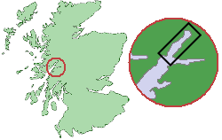
From en.wikipedia. Original comment was: " Map showing the location of Loch Linnhe within Scotland
| Dit werk komt niet in aanmerking voor auteursrechtelijke bescherming, omdat het volledig uit algemeen beschikbare informatie bestaat en geen origineel auteurschap bevat; derhalve valt het werk in het publieke domein. |
Original work of submitter.
Source of map outline was Image:Scotland_Map.png, template was Image:Scotland_Map_(Firth_of_Lorn_Detail).png "
.png&action=edit&redlink=1)
Bestandsgeschiedenis
Klik op een datum/tijd om het bestand te zien zoals het destijds was.
| Datum/tijd | Miniatuur | Afmetingen | Gebruiker | Opmerking | |
|---|---|---|---|---|---|
| huidige versie | 10 sep 2005 13:50 | | 250 × 158 (14 kB) | Tbc | From en.wikipedia. Original comment was: " Map showing the location of Loch Linnhe within Scotland {{PD}} Original work of submitter. Source of map outline was Image:Scotland_Map.png, template was Image:Scotland_Map_(Firth_of_Lorn_Detail).png |
.png&action=edit&redlink=1)
Bestandsgebruik
Dit bestand wordt op de volgende pagina gebruikt:
Globaal bestandsgebruik
De volgende andere wiki's gebruiken dit bestand:
- Gebruikt op no.wikipedia.org
- Gebruikt op sh.wikipedia.org
_Loch_Linnhe.png)