
Bestand:Shropshire outline map with UK (2009).png
Geen hogere resolutie beschikbaar.
Shropshire_outline_map_with_UK_(2009).png (504 × 549 pixels, bestandsgrootte: 141 kB, MIME-type: image/png)
| Dit is een bestand van Wikimedia Commons. Onderstaande beschrijving komt van de beschrijving van het bestand daar. |
.png)
Beschrijving
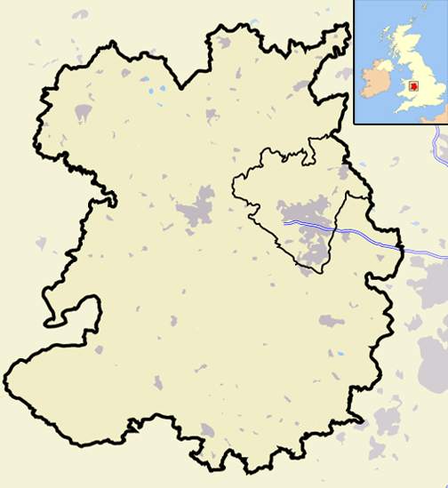
| Beschrijving | A map of the county of Shropshire, England, United Kingdom, showing the post-2009 district boundaries. |
| Datum | |
| Bron | Eigen werk |
| Auteur | Jhamez84 |
Licentie
| Ik, de auteursrechthebbende van dit werk, geef dit werk vrij in het publieke domein. Dit is wereldwijd van toepassing. In sommige landen is dit wettelijk niet mogelijk; in die gevallen geldt: Ik sta iedereen toe dit werk voor eender welk doel te gebruiken, zonder enige voorwaarden, tenzij zulke voorwaarden door de wet worden voorgeschreven. |
Bestandsgeschiedenis
Klik op een datum/tijd om het bestand te zien zoals het destijds was.
| Datum/tijd | Miniatuur | Afmetingen | Gebruiker | Opmerking | |
|---|---|---|---|---|---|
| huidige versie | 19 dec 2008 22:06 | | 504 × 549 (141 kB) | Jza84 | == Summary == {{Information |Description=A map of the county of Shropshire, England, United Kingdom, showing the post-2009 district boundaries. |Source=self-made |Date=December 2008 |Author= Jhamez84 |Permission=See below |other_versions |
Bestandsgebruik
Geen enkele pagina gebruikt dit bestand.
Globaal bestandsgebruik
De volgende andere wiki's gebruiken dit bestand:
- Gebruikt op en.wikipedia.org
- Talk:Charles Darwin
- Talk:River Severn
- Crewe and Nantwich
- Talk:Shrewsbury School
- South Shropshire
- Talk:Richard of Shrewsbury, Duke of York
- Ellesmere Port and Neston
- Talk:Shropshire
- Shrewsbury and Atcham
- Talk:Church Stretton
- Castle Morpeth
- Vale Royal
- Blyth Valley
- Wansbeck District
- Tynedale
- Mid Bedfordshire District
- South Bedfordshire
- Penwith
- Kerrier
- Carrick, Cornwall
- Restormel
- Caradon
- North Cornwall
- Teesdale (district)
- Wear Valley
- Derwentside
- North Shropshire
- Kennet District
- West Wiltshire
- North Wiltshire
- Borough of Berwick-upon-Tweed
- Alnwick District
- Bridgnorth District
- Sedgefield (borough)
- Easington District
- Macclesfield (borough)
- Talk:Sheriffhales
- Congleton (borough)
- Chester (district)
- Salisbury District
- Borough of Oswestry
- City of Durham (district)
- Chester-le-Street (district)
- Talk:Weston Lullingfields
- Talk:Ludlow
- Talk:Oswestry School
- Shropshire Wildlife Trust
- Talk:Bridgnorth
- Talk:A. E. Housman
- Talk:Welsh Marches
Globaal gebruik van dit bestand bekijken.
.png)
.png)