
Bestand:Spain Canary Islands location map.svg

Afmetingen van deze voorvertoning van het type PNG van dit SVG-bestand: 800 × 355 pixels Andere resoluties: 320 × 142 pixels | 640 × 284 pixels | 1.024 × 455 pixels | 1.280 × 568 pixels | 2.560 × 1.137 pixels | 1.475 × 655 pixels.
Oorspronkelijk bestand (SVG-bestand, nominaal 1.475 × 655 pixels, bestandsgrootte: 29 kB)
| Dit is een bestand van Wikimedia Commons. Onderstaande beschrijving komt van de beschrijving van het bestand daar. |
Beschrijving
| Beschrijving |
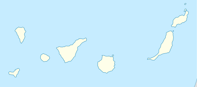
Quadratische Plattkarte, N-S-Streckung 110 %. Geographische Begrenzung der Karte:
Equirectangular projection, N/S stretching 110 %. Geographic limits of the map:
|
||
| Datum | 10-08-2008 | ||
| Bron | own work, using World Data Base II data | ||
| Auteur | NordNordWest | ||
| Andere versies | Afgeleide werken van dit bestand: Spain Canary Islands location map with Spain.png | ||
| SVG ontwikkeling | De broncode van dit SVG-bestand is deugdelijk.
|

Licentie
Ik, de auteursrechthebbende van dit werk, maak het hierbij onder de volgende licenties beschikbaar:

|
Toestemming wordt verleend voor het kopiëren, verspreiden en/of wijzigen van dit document onder de voorwaarden van de GNU-licentie voor vrije documentatie, versie 1.2 of enige latere versie als gepubliceerd door de Free Software Foundation; zonder Invariant Sections, zonder Front-Cover Texts, en zonder Back-Cover Texts. Een kopie van de licentie is opgenomen in de sectie GNU-licentie voor vrije documentatie. |
Dit bestand is gelicenseerd onder de Creative Commons-licentie Naamsvermelding-Gelijk delen 3.0 Unported
- De gebruiker mag:
- Delen – het werk kopiëren, verspreiden en doorgeven
- Remixen – afgeleide werken maken
- Onder de volgende voorwaarden:
- naamsvermelding – U moet op een gepaste manier aan naamsvermelding doen, een link naar de licentie geven, en aangeven of er wijzigingen in het werk zijn aangebracht. U mag dit op elke redelijke manier doen, maar niet zodanig dat de indruk wordt gewekt dat de licentiegever instemt met uw werk of uw gebruik van zijn werk.
- Gelijk delen – Als u het werk heeft geremixt, veranderd, of erop heeft voortgebouwd, moet u het gewijzigde materiaal verspreiden onder dezelfde licentie als het oorspronkelijke werk, of een daarmee compatibele licentie.
U mag zelf één van de licenties kiezen.
Bestandsgeschiedenis
Klik op een datum/tijd om het bestand te zien zoals het destijds was.
| Datum/tijd | Miniatuur | Afmetingen | Gebruiker | Opmerking | |
|---|---|---|---|---|---|
| huidige versie | 29 aug 2008 10:36 | | 1.475 × 655 (29 kB) | NordNordWest | |
| 10 aug 2008 20:55 |  | 492 × 218 (33 kB) | NordNordWest | {{Information |Description= {{de|Positionskarte der Kanarischen Inseln, Spanien}} Quadratische Plattkarte, N-S-Streckung 110 %. Geographische Begrenzung der Karte: * N: 29.5° N * S: 27.4° N * W: 18.4° W * O: 13.2° |
Bestandsgebruik
Geen enkele pagina gebruikt dit bestand.
Globaal bestandsgebruik
De volgende andere wiki's gebruiken dit bestand:
- Gebruikt op af.wikipedia.org
- Gebruikt op az.wikipedia.org
- Gebruikt op ba.wikipedia.org
- Gebruikt op be-tarask.wikipedia.org
- Gebruikt op be.wikipedia.org
- Gebruikt op ce.wikipedia.org
- Gebruikt op cs.wikipedia.org
- Las Palmas de Gran Canaria
- Pico del Teide
- Národní park Teide
- Santa Cruz de Tenerife
- Garajonay
- San Cristóbal de La Laguna
- Šablona:LocMap Kanárské ostrovy
- Mogán
- Šablona:LocMap vícenásobně
- Šablona:LocMap vícenásobně/doc
- Kostel Neposkvrněného početí Panny Marie (Santa Cruz de Tenerife)
- Kostel Neposkvrněného početí Panny Marie (San Cristóbal de La Laguna)
- Guayadeque
- Caldera de Taburiente
- Národní park Timanfaya
- Cumbre Vieja
- Fuerteventura (sopka)
- Lanzarote (sopka)
- Gran Canaria (sopka)
- Costa Calma
- Zednářský chrám v Santa Cruz de Tenerife
Globaal gebruik van dit bestand bekijken.