
Bestand:Ukraine license plate codes.png

Grootte van deze voorvertoning: 800 × 559 pixels. Andere resoluties: 320 × 224 pixels | 640 × 447 pixels | 1.024 × 715 pixels | 1.181 × 825 pixels.
Oorspronkelijk bestand (1.181 × 825 pixels, bestandsgrootte: 49 kB, MIME-type: image/png)
| Dit is een bestand van Wikimedia Commons. Onderstaande beschrijving komt van de beschrijving van het bestand daar. |
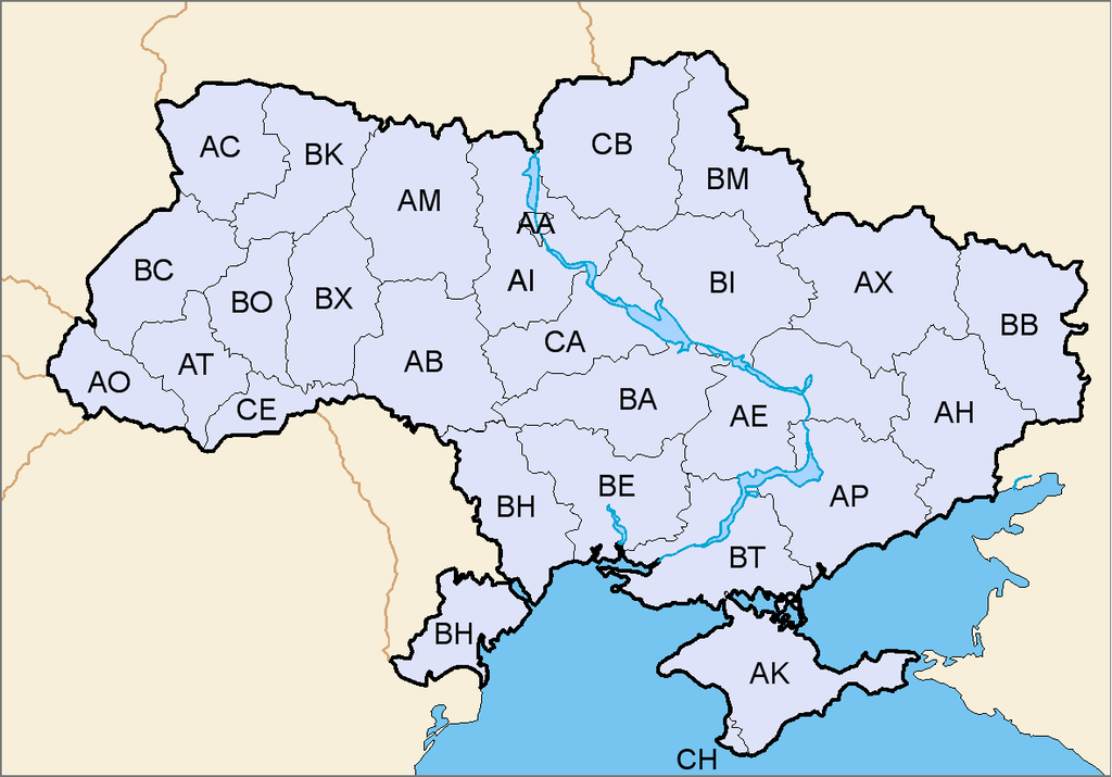
| Beschrijving | Map of license plate codes of Ukraine |
| Datum | (UTC) |
| Bron | |
| Auteur |
|
| Dit is een geretoucheerde foto, wat betekent dat de originele versie digitaal aangepast is. Aanpassingen: added license plate codes. Het origineel kan hier bekeken worden: Map of Ukraine simple blank.png. Aanpassingen gedaan door TheFlyingDutchman.
|
Ik, de auteursrechthebbende van dit werk, maak het hierbij onder de volgende licentie beschikbaar:

|
Toestemming wordt verleend voor het kopiëren, verspreiden en/of wijzigen van dit document onder de voorwaarden van de GNU-licentie voor vrije documentatie, versie 1.2 of enige latere versie als gepubliceerd door de Free Software Foundation; zonder Invariant Sections, zonder Front-Cover Texts, en zonder Back-Cover Texts. Een kopie van de licentie is opgenomen in de sectie GNU-licentie voor vrije documentatie. |
| Dit bestand is gelicenseerd onder de Creative Commons-licentie Naamsvermelding-Gelijk delen 3.0 Unported | ||
| ||
| Deze licentietag is toegevoegd aan dit bestand in verband met de GFDL licentie-update. |
Oorspronkelijk uploadlogboek
This image is a derivative work of the following images:
- Image:Map_of_Ukraine_simple_blank.png licensed with GFDL
Uploaded with derivativeFX
Bestandsgeschiedenis
Klik op een datum/tijd om het bestand te zien zoals het destijds was.
| Datum/tijd | Miniatuur | Afmetingen | Gebruiker | Opmerking | |
|---|---|---|---|---|---|
| huidige versie | 7 mei 2014 12:11 | | 1.181 × 825 (49 kB) | Matma Rex | Reverted to version as of 13:54, 3 March 2014, very low-quality edit, disputed correctness especially in context of place codes map |
| 23 apr 2014 23:13 |  | 1.181 × 825 (70 kB) | Kolya781 | Без Крыма и Севастополя | |
| 3 mrt 2014 15:54 |  | 1.181 × 825 (49 kB) | Artemco | Киев и Севастополь | |
| 13 sep 2008 12:10 |  | 1.181 × 825 (73 kB) | TheFlyingDutchman | {{Information |Description=Map of license plate codes of Ukraine |Source=*Image:Map_of_Ukraine_simple_blank.png |Date=2008-09-13 10:09 (UTC) |Author=*derivative work: ~~~ *Image:Map_of_Ukraine_simple_blank.png: ickis |Permission |
Bestandsgebruik
Dit bestand wordt op de volgende pagina gebruikt:
Globaal bestandsgebruik
De volgende andere wiki's gebruiken dit bestand:
- Gebruikt op cs.wikipedia.org
- Gebruikt op de.wikipedia.org
- Gebruikt op el.wikipedia.org
- Gebruikt op lt.wikipedia.org
- Gebruikt op pl.wikipedia.org
- Gebruikt op ro.wikipedia.org