
Bestand:Image-Peru and Gran Colombia map in 1828.PNG
Grootte van deze voorvertoning: 419 × 600 pixels. Andere resoluties: 167 × 240 pixels | 335 × 480 pixels | 651 × 932 pixels.
Oorspronkelijk bestand (651 × 932 pixels, bestandsgrootte: 20 kB, MIME-type: image/png)
| Dit is een bestand van Wikimedia Commons. Onderstaande beschrijving komt van de beschrijving van het bestand daar. |

|
Deze kaartafbeelding zou opnieuw moeten worden aangemaakt als een SVG-bestand door vectorafbeeldingen te gebruiken. Dit heeft een aantal voordelen; zie Commons:Media for cleanup voor meer informatie. Als er een SVG-formaat van deze afbeelding bestaat, dan deze graag uploaden. Nadat u dit heeft gedaan, gelieve dit sjabloon te vervangen door het sjabloon {{vector version available|nieuwe bestandsnaam.svg}} op deze afbeeldingspagina.
|
Beschrijving
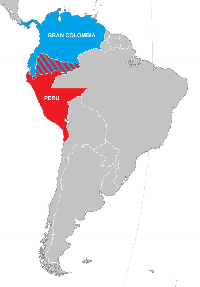
| Beschrijving | Map of Peru and Gran Colombia during war of 1828 |
| Datum | |
| Bron | Made from Image:BlankMap-World.png) |
| Auteur | Vivaperucarajo |
| Toestemming (Hergebruik van dit bestand) |
own work |
Licentie

|
Toestemming wordt verleend voor het kopiëren, verspreiden en/of wijzigen van dit document onder de voorwaarden van de GNU-licentie voor vrije documentatie, versie 1.2 of enige latere versie als gepubliceerd door de Free Software Foundation; zonder Invariant Sections, zonder Front-Cover Texts, en zonder Back-Cover Texts. Een kopie van de licentie is opgenomen in de sectie GNU-licentie voor vrije documentatie. |
| Dit bestand is gelicenseerd onder de Creative Commons-licentie Naamsvermelding-Gelijk delen 3.0 Unported | ||
| ||
| Deze licentietag is toegevoegd aan dit bestand in verband met de GFDL licentie-update. |
Bestandsgeschiedenis
Klik op een datum/tijd om het bestand te zien zoals het destijds was.
| Datum/tijd | Miniatuur | Afmetingen | Gebruiker | Opmerking | |
|---|---|---|---|---|---|
| huidige versie | 25 apr 2019 04:19 | | 651 × 932 (20 kB) | Marcomogollon | Texto con los países en disputa |
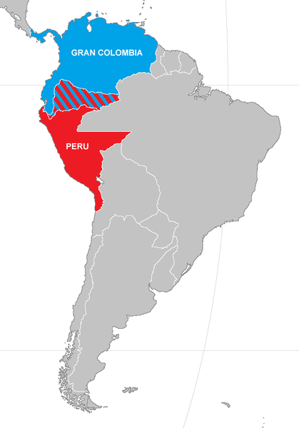
| 15 jan 2015 19:42 |  | 651 × 932 (22 kB) | Milenioscuro | mejora en el mapa | |
| 26 apr 2008 23:36 |  | 420 × 620 (12 kB) | Vivaperucarajo~commonswiki | == Summary == {{Information |Description=Map of Peru and Gran Colombia during war of 1828 |Source=Made from Image:BlankMap-World.png) |Date=2008 |Author=Vivaperucarajo |Permission=own work |other_versions=none }} == Licensing: == {{GFDL}} [[Template: |
Bestandsgebruik
Dit bestand wordt op de volgende pagina gebruikt:
Globaal bestandsgebruik
De volgende andere wiki's gebruiken dit bestand:
- Gebruikt op ar.wikipedia.org
- Gebruikt op az.wikipedia.org
- Gebruikt op ca.wikipedia.org
- Gebruikt op en.wikipedia.org
- Gebruikt op es.wikipedia.org
- Gebruikt op fr.wikipedia.org
- Gebruikt op ka.wikipedia.org
- Gebruikt op sv.wikipedia.org
- Gebruikt op tr.wikipedia.org
- Gebruikt op uk.wikipedia.org
- Gebruikt op vi.wikipedia.org