
Bestand:Insurance Plan of City of London Vol. I; sheet 23 (BL 150118).tiff

Afmetingen van deze voorvertoning van het type JPG van dit TIF-bestand: 513 × 600 pixels Andere resoluties: 205 × 240 pixels | 411 × 480 pixels | 657 × 768 pixels | 876 × 1.024 pixels | 1.752 × 2.048 pixels | 3.159 × 3.693 pixels.
Oorspronkelijk bestand (3.159 × 3.693 pixels, bestandsgrootte: 33,38 MB, MIME-type: image/tiff)
| Dit is een bestand van Wikimedia Commons. Onderstaande beschrijving komt van de beschrijving van het bestand daar. |
Beschrijving
Licentie
|
Dit werk bevindt zich in het publiek domein in landen en gebieden waar de auteursrechttermijn het leven van de auteur plus 100 jaar of minder is. Dit werk bevindt zich in het publiek domein in de Verenigde Staten omdat het gepubliceerd werd (of geregistreerd bij de U.S. Copyright Office) voor 1 januari 1929. | |
| Van dit bestand is vastgesteld dat er geen bekende auteursrechtaanspraken op rusten, alle aanverwante en naburige rechten daarbij inbegrepen. | |
Bestandsgeschiedenis
Klik op een datum/tijd om het bestand te zien zoals het destijds was.
| Datum/tijd | Miniatuur | Afmetingen | Gebruiker | Opmerking | |
|---|---|---|---|---|---|
| huidige versie | 24 mrt 2017 20:39 | 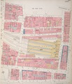 | 3.159 × 3.693 (33,38 MB) | Fæ | British Library Fire insurance maps, #313, http://www.bl.uk/onlinegallery/onlineex/firemaps/england/london/itov/mapsu145ubu22u1uf023r.html |
Bestandsgebruik
Dit bestand wordt op de volgende pagina gebruikt:
Globaal bestandsgebruik
De volgende andere wiki's gebruiken dit bestand:
- Gebruikt op bn.wikipedia.org
- Gebruikt op en.wikipedia.org
- Gebruikt op zh.wikipedia.org