
Bestand:Locator map of the Duchy of Bouillon (1560).svg

Afmetingen van deze voorvertoning van het type PNG van dit SVG-bestand: 800 × 530 pixels Andere resoluties: 320 × 212 pixels | 640 × 424 pixels | 1.024 × 678 pixels | 1.280 × 848 pixels | 2.560 × 1.695 pixels | 5.029 × 3.330 pixels.
Oorspronkelijk bestand (SVG-bestand, nominaal 5.029 × 3.330 pixels, bestandsgrootte: 576 kB)
| Dit is een bestand van Wikimedia Commons. Onderstaande beschrijving komt van de beschrijving van het bestand daar. |
.svg)
Beschrijving
| Beschrijving |
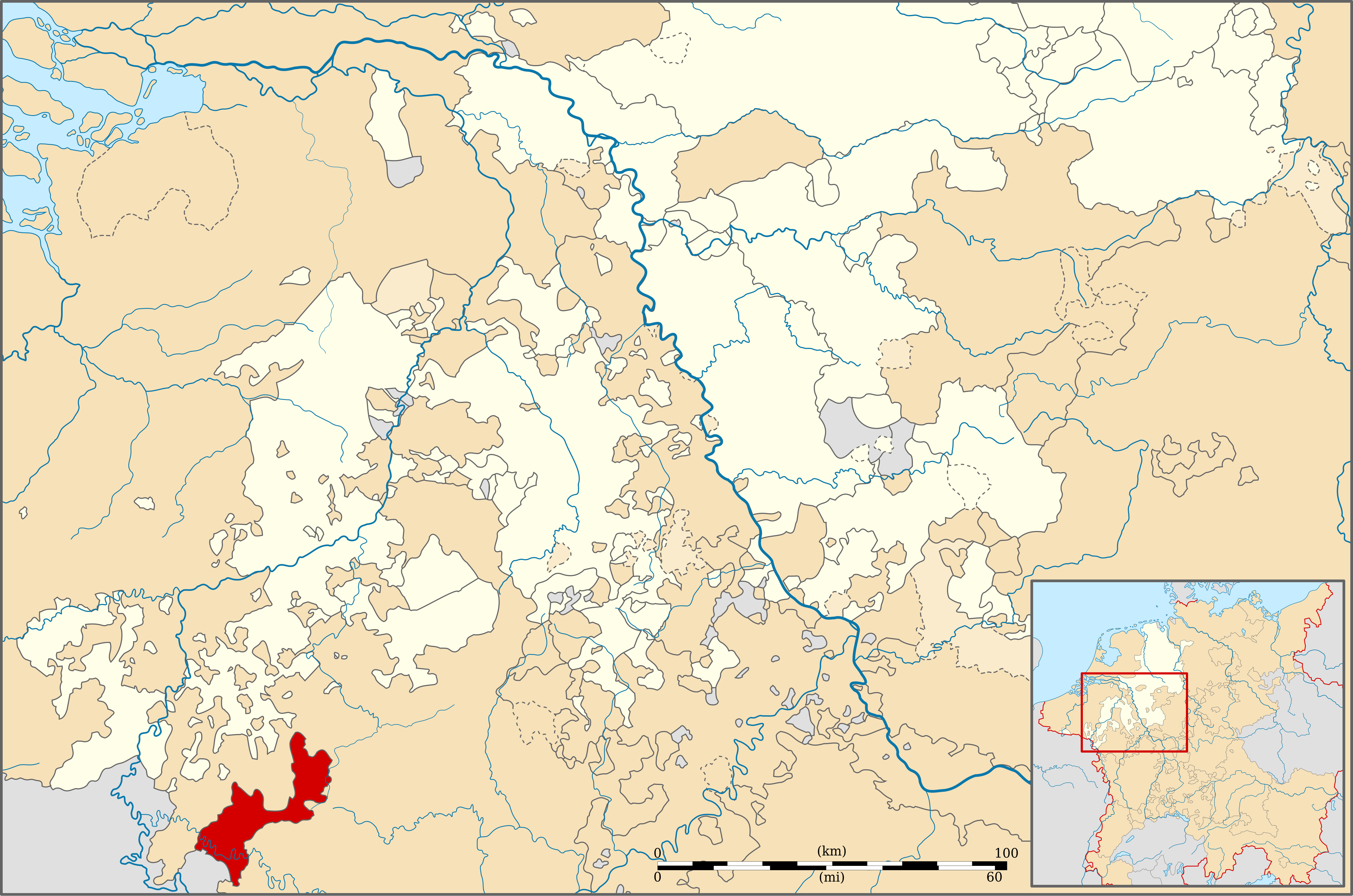
English: Locator map of the Duchy of Bouillon (1560) |
| Datum | |
| Bron | Geschichtlicher Handatlas von Westfalen (1975) |
| Auteur | Sir Iain |
Licentie
Dit bestand is gelicenseerd onder de Creative Commons-licentie Naamsvermelding-Gelijk delen 3.0 Unported
- De gebruiker mag:
- Delen – het werk kopiëren, verspreiden en doorgeven
- Remixen – afgeleide werken maken
- Onder de volgende voorwaarden:
- naamsvermelding – U moet op een gepaste manier aan naamsvermelding doen, een link naar de licentie geven, en aangeven of er wijzigingen in het werk zijn aangebracht. U mag dit op elke redelijke manier doen, maar niet zodanig dat de indruk wordt gewekt dat de licentiegever instemt met uw werk of uw gebruik van zijn werk.
- Gelijk delen – Als u het werk heeft geremixt, veranderd, of erop heeft voortgebouwd, moet u het gewijzigde materiaal verspreiden onder dezelfde licentie als het oorspronkelijke werk, of een daarmee compatibele licentie.
Bestandsgeschiedenis
Klik op een datum/tijd om het bestand te zien zoals het destijds was.
| Datum/tijd | Miniatuur | Afmetingen | Gebruiker | Opmerking | |
|---|---|---|---|---|---|
| huidige versie | 12 dec 2010 00:31 | | 5.029 × 3.330 (576 kB) | Sir Iain | {{Information |Description=Locator map of the Duchy of Boulion (1560) |Source=Geschichtlicher Handatlas von Westfalen (1975) |Date=13/09/2010 |Author=Sir Iain |Permission= |other_versions= }} {{cc-by-sa-3.0}} [[Category:Maps of territories in the Westphal |
Bestandsgebruik
Dit bestand wordt op de volgende pagina gebruikt:
Globaal bestandsgebruik
De volgende andere wiki's gebruiken dit bestand:
- Gebruikt op ar.wikipedia.org
- Gebruikt op de.wikipedia.org
- Gebruikt op en.wikipedia.org
- Gebruikt op fr.wikipedia.org
- Gebruikt op it.wikipedia.org
- Gebruikt op lt.wikipedia.org
- Gebruikt op pt.wikipedia.org
- Gebruikt op ru.wikipedia.org
- Gebruikt op simple.wikipedia.org
.svg)