
Bestand:Malawi relief location map.jpg
Grootte van deze voorvertoning: 292 × 599 pixels. Andere resoluties: 117 × 240 pixels | 234 × 480 pixels | 945 × 1.937 pixels.
Oorspronkelijk bestand (945 × 1.937 pixels, bestandsgrootte: 487 kB, MIME-type: image/jpeg)
| Dit is een bestand van Wikimedia Commons. Onderstaande beschrijving komt van de beschrijving van het bestand daar. |
Beschrijving
| Beschrijving |
Español: Mapa de localización de Malaui
Deutsch: Positionskarte von Malawi
Quadratische Plattkarte. Geographische Begrenzung der Karte:
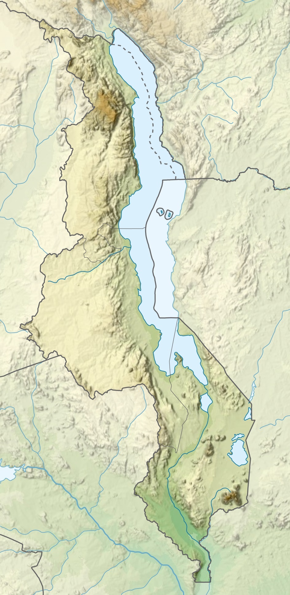
English: Location map of Malawi
Equirectangular projection. Geographic limits of the map:
|
| Datum | |
| Bron |
Dit bestand is afgeleid van: |
| Auteur |
|
Licentie
Ik, de auteursrechthebbende van dit werk, maak het hierbij onder de volgende licenties beschikbaar:

|
Toestemming wordt verleend voor het kopiëren, verspreiden en/of wijzigen van dit document onder de voorwaarden van de GNU-licentie voor vrije documentatie, versie 1.2 of enige latere versie als gepubliceerd door de Free Software Foundation; zonder Invariant Sections, zonder Front-Cover Texts, en zonder Back-Cover Texts. Een kopie van de licentie is opgenomen in de sectie GNU-licentie voor vrije documentatie. |
Dit bestand is gelicenseerd onder de Creative Commons-licentie Naamsvermelding-Gelijk delen 3.0 Unported
- De gebruiker mag:
- Delen – het werk kopiëren, verspreiden en doorgeven
- Remixen – afgeleide werken maken
- Onder de volgende voorwaarden:
- naamsvermelding – U moet op een gepaste manier aan naamsvermelding doen, een link naar de licentie geven, en aangeven of er wijzigingen in het werk zijn aangebracht. U mag dit op elke redelijke manier doen, maar niet zodanig dat de indruk wordt gewekt dat de licentiegever instemt met uw werk of uw gebruik van zijn werk.
- Gelijk delen – Als u het werk heeft geremixt, veranderd, of erop heeft voortgebouwd, moet u het gewijzigde materiaal verspreiden onder dezelfde licentie als het oorspronkelijke werk, of een daarmee compatibele licentie.
U mag zelf één van de licenties kiezen.
Bestandsgeschiedenis
Klik op een datum/tijd om het bestand te zien zoals het destijds was.
| Datum/tijd | Miniatuur | Afmetingen | Gebruiker | Opmerking | |
|---|---|---|---|---|---|
| huidige versie | 3 mrt 2020 22:29 | | 945 × 1.937 (487 kB) | Sémhur | Adding Tanzanian border claim (from https://www.nbs.go.tz/index.php/en/census-surveys/gis/385-2012-phc-shapefiles-level-one-and-two) |
| 20 jan 2015 21:26 |  | 945 × 1.937 (499 kB) | Milenioscuro | User created page with UploadWizard |
Bestandsgebruik
Dit bestand wordt op de volgende 9 pagina's gebruikt:
Globaal bestandsgebruik
De volgende andere wiki's gebruiken dit bestand:
- Gebruikt op af.wikipedia.org
- Gebruikt op ast.wikipedia.org
- Gebruikt op avk.wikipedia.org
- Gebruikt op az.wikipedia.org
- Gebruikt op ban.wikipedia.org
- Gebruikt op be.wikipedia.org
- Gebruikt op bg.wikipedia.org
- Gebruikt op bn.wikipedia.org
- Gebruikt op da.wikipedia.org
- Gebruikt op de.wikipedia.org
- Malawi
- Malawisee
- Mulanje (Bergmassiv)
- Kapichira-Wasserfälle
- Shire-Hochland
- Elephant Marsh
- Malombesee
- Chilwa-See
- Nyika-Plateau
- Chizumulu
- Nchenachena
- Nganda
- Salanjama
- Kasungu-Nationalpark
- Viphya Mountains
- Chongoni
- Vorlage:Positionskarte Malawi
- Wikipedia:Kartenwerkstatt/Positionskarten/Afrika
- Chisi Island
- Kaulime-See
- Likoma (Insel)
Globaal gebruik van dit bestand bekijken.