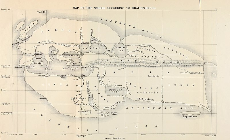
Bestand:Mappa di Eratostene.jpg

Grootte van deze voorvertoning: 800 × 487 pixels. Andere resoluties: 320 × 195 pixels | 640 × 390 pixels | 1.024 × 623 pixels | 1.280 × 779 pixels | 2.560 × 1.559 pixels | 5.085 × 3.096 pixels.
Oorspronkelijk bestand (5.085 × 3.096 pixels, bestandsgrootte: 2,37 MB, MIME-type: image/jpeg)
Bestandsgeschiedenis
Klik op een datum/tijd om het bestand te zien zoals het destijds was.
| Datum/tijd | Miniatuur | Afmetingen | Gebruiker | Opmerking | |
|---|---|---|---|---|---|
| huidige versie | 5 jul 2020 16:51 |  | 5.085 × 3.096 (2,37 MB) | Sette-quattro | Higher resolution version, from https://archive.org/details/historyofancient00bunb/page/n720/mode/2up |
| 24 jun 2007 21:12 |  | 1.040 × 611 (149 kB) | TcfkaPanairjdde | Mappa di Eratostene, da en.wiki en:Iran.jpg La mappa è tratta da: * Bunbury, E.H., ''A History of Ancient Geography among the Greeks and Romans from the Earliest Ages till the Fall of the Roman Empire''. London: John Murray, 1883. {{PD-Art}} |
Bestandsgebruik
Dit bestand wordt op de volgende 3 pagina's gebruikt:
Globaal bestandsgebruik
De volgende andere wiki's gebruiken dit bestand:
- Gebruikt op af.wikipedia.org
- Gebruikt op ar.wikipedia.org
- Gebruikt op az.wikipedia.org
- Gebruikt op be-tarask.wikipedia.org
- Gebruikt op bs.wikipedia.org
- Gebruikt op ca.wikipedia.org
- Gebruikt op ceb.wikipedia.org
- Gebruikt op cs.wikipedia.org
- Gebruikt op de.wikipedia.org
- Gebruikt op diq.wikipedia.org
- Gebruikt op el.wikipedia.org
- Gebruikt op en.wikipedia.org
- Alexander the Great
- Eratosthenes
- Seleucus I Nicator
- Persian Gulf naming dispute
- Taprobana
- Name of Iran
- Early world maps
- History of the Indo-Greek Kingdom
- User:Campstriker
- Sources of Indo-Greek history
- User:MinisterForBadTimes/Themistocles
- Homonoia
- Travel in classical antiquity
- User talk:Mdd/History of technical drawing
- User:Falcaorib
- Gebruikt op es.wikipedia.org
- Gebruikt op eu.wikipedia.org
- Gebruikt op fa.wikipedia.org
Globaal gebruik van dit bestand bekijken.


