
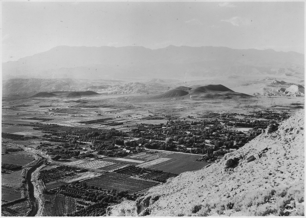
Bestand:View of village of Hurricane, Utah, from top of Hurricane Hill, showing fertility of surrounding land. The two low... - NARA - 520412.tif

Oorspronkelijk bestand (3.000 × 2.143 pixels, bestandsgrootte: 6,13 MB, MIME-type: image/tiff)
| Dit is een bestand van Wikimedia Commons. Onderstaande beschrijving komt van de beschrijving van het bestand daar. |
Beschrijving
| View of village of Hurricane, Utah, from top of Hurricane Hill, showing fertility of surrounding land. The two low volcanoes at back of town were on Escalante's trail in 1776. View looking northwest, Pine Valley Mountain in distance.
( |
|||||||||||||||||||||||||||
|---|---|---|---|---|---|---|---|---|---|---|---|---|---|---|---|---|---|---|---|---|---|---|---|---|---|---|---|
| Auteur |
|
||||||||||||||||||||||||||
| Record creator | Department of the Interior. National Park Service. (1916 - 1933) | ||||||||||||||||||||||||||
| Titel |
View of village of Hurricane, Utah, from top of Hurricane Hill, showing fertility of surrounding land. The two low volcanoes at back of town were on Escalante's trail in 1776. View looking northwest, Pine Valley Mountain in distance. |
||||||||||||||||||||||||||
| Afgebeelde plaats |
Utah (United States, North and Central America) state (40°00′00″N 110°00′00″W / 40°N 110°W; NARA geographical record) |
||||||||||||||||||||||||||
| Datum | 6 september 1929 | ||||||||||||||||||||||||||
| Collectie |
|
||||||||||||||||||||||||||
| Record ID |
|
||||||||||||||||||||||||||
| Bron | U.S. National Archives and Records Administration | ||||||||||||||||||||||||||
| Andere versies |
Gelieve niet de oorspronkelijke bestanden te overschrijven: bijknippen of ander restauratiewerk dient apart te worden geüpload en gelinkt aan deze pagina met de "other versions=" parameter, zodat dit bestand de exacte versie is zoals uit de gegevensbank van de NARA waar de pagina naar verwijst is verkregen. De metadata op deze pagina zijn rechtstreeks geïmporteerd uit de database van de NARA; aanvullende beschrijvende tekst kan door Wikimedianen worden toegevoegd aan het sjabloon hieronder met de "description=" parameter, maar pas altublieft de andere velden niet aan.
|
||||||||||||||||||||||||||


Licentie
Dit bestand is bijgedragen aan Wikimedia Commons door de National Archives and Records Administration als onderdeel van een samenwerkingsproject. De National Archives and Records Administration heeft afbeeldingen van de Amerikaanse en mondiale historie aangeleverd. Deze afbeeldingen zijn in het publiek domein of zijn beschikbaar gesteld onder een vrije licentie.
|
| Dit beeld- of mediabestand bevat materiaal gebaseerd op een werk van een National Park Service medewerker, gemaakt als onderdeel van de officiële taken van die persoon. Als een werk van de Amerikaanse federale overheid, bevindt dergelijk werk zich in het publieke domein in de Verenigde Staten. Zie de NPS website en NPS copyright policy voor meer informatie. |
Bestandsgeschiedenis
Klik op een datum/tijd om het bestand te zien zoals het destijds was.
| Datum/tijd | Miniatuur | Afmetingen | Gebruiker | Opmerking | |
|---|---|---|---|---|---|
| huidige versie | 3 okt 2011 01:12 |  | 3.000 × 2.143 (6,13 MB) | US National Archives bot | == {{int:filedesc}} == {{NARA-image-full |Title=View of village of Hurricane, Utah, from top of Hurricane Hill, showing fertility of surrounding land. The two low volcanoes at back of town were on Escalante's trail in 1776. View looking northwest, Pine V |
Bestandsgebruik
Dit bestand wordt op de volgende pagina gebruikt: