
Bestand:Alice Springs ridge.jpeg
Geen hogere resolutie beschikbaar.
Alice_Springs_ridge.jpeg (768 × 511 pixels, bestandsgrootte: 436 kB, MIME-type: image/jpeg)
| Dit is een bestand van Wikimedia Commons. Onderstaande beschrijving komt van de beschrijving van het bestand daar. |
Beschrijving
| Cameralocatie | | Deze en andere afbeeldingen in: OpenStreetMap |
|---|
Licentie
Codrington, Stephen. Planet Geography 3rd Edition (2005) [1]
Personal photo by Stephen Codrington uploaded with permission for the benefit of geography on Wikimedia projects. This and other photos by Stephen Codrington are available to download and order at his personal website.
Dit bestand is gelicenseerd onder de Creative Commons-licentie Naamsvermelding 2.5 Unported
Naamsvermelding: Stephen Codrington
- De gebruiker mag:
- Delen – het werk kopiëren, verspreiden en doorgeven
- Remixen – afgeleide werken maken
- Onder de volgende voorwaarden:
- naamsvermelding – U moet op een gepaste manier aan naamsvermelding doen, een link naar de licentie geven, en aangeven of er wijzigingen in het werk zijn aangebracht. U mag dit op elke redelijke manier doen, maar niet zodanig dat de indruk wordt gewekt dat de licentiegever instemt met uw werk of uw gebruik van zijn werk.
Bestandsgeschiedenis
Klik op een datum/tijd om het bestand te zien zoals het destijds was.
| Datum/tijd | Miniatuur | Afmetingen | Gebruiker | Opmerking | |
|---|---|---|---|---|---|
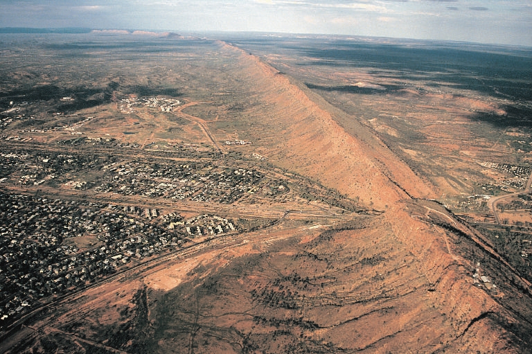
| huidige versie | 12 jul 2005 04:57 | | 768 × 511 (436 kB) | Komencanto~commonswiki | Caption: "''Figure 3.14 One of the larger settlements on the road that crosses Australia from north to south is Alice Springs. This view shows the transport links passing through a convenient gap in the ridge beside which the town has been built. The host |
Bestandsgebruik
Dit bestand wordt op de volgende pagina gebruikt:
Globaal bestandsgebruik
De volgende andere wiki's gebruiken dit bestand:
- Gebruikt op af.wikipedia.org
- Gebruikt op arz.wikipedia.org
- Gebruikt op bg.wikipedia.org
- Gebruikt op de.wikipedia.org
- Gebruikt op de.wikivoyage.org
- Gebruikt op en.wikipedia.org
- Gebruikt op es.wikipedia.org
- Gebruikt op fr.wikipedia.org
- Gebruikt op fr.wikivoyage.org
- Gebruikt op hu.wikipedia.org
- Gebruikt op it.wikipedia.org
- Gebruikt op ja.wikipedia.org
- Gebruikt op ky.wikipedia.org
- Gebruikt op ml.wikipedia.org
- Gebruikt op nn.wikipedia.org
- Gebruikt op ru.wikipedia.org
- Gebruikt op simple.wikipedia.org
- Gebruikt op tr.wikipedia.org
- Gebruikt op uk.wikipedia.org
- Gebruikt op vi.wikipedia.org
- Gebruikt op www.wikidata.org