
Bestand:American Revolutionary War Cobleskill and Cherry Valley.jpg
Grootte van deze voorvertoning: 800 × 531 pixels. Andere resoluties: 320 × 212 pixels | 640 × 425 pixels | 1.024 × 679 pixels | 1.280 × 849 pixels | 2.086 × 1.384 pixels.
Oorspronkelijk bestand (2.086 × 1.384 pixels, bestandsgrootte: 543 kB, MIME-type: image/jpeg)
| Dit is een bestand van Wikimedia Commons. Onderstaande beschrijving komt van de beschrijving van het bestand daar. |
Beschrijving
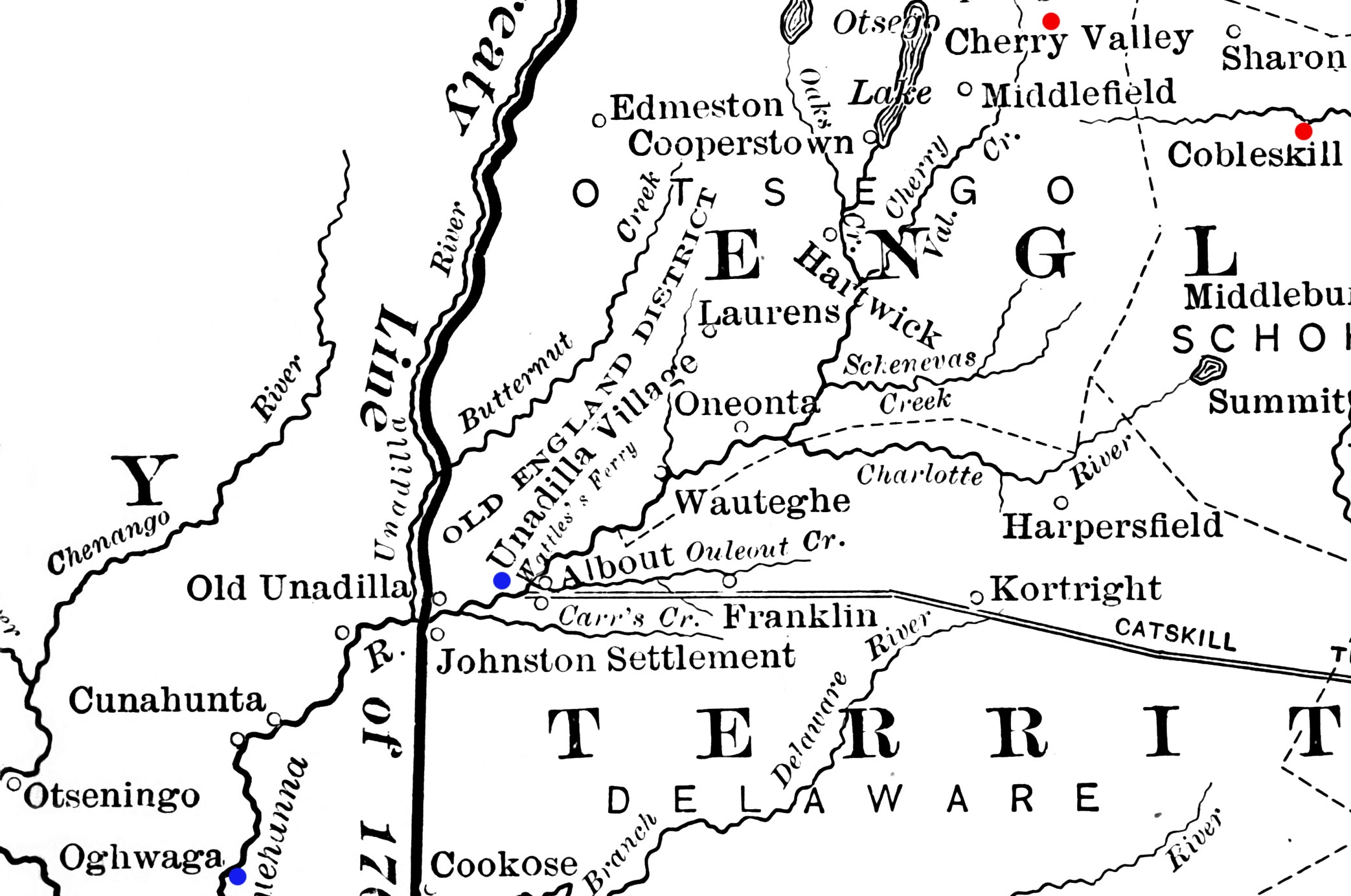
| Beschrijving | Detail from a map showing a portion of New York's western frontier with the Iroquois. The New York communities of Cherry Valley and Cobleskill, the scenes of military actions in the American Revolutionary War in 1778, are highlighted in red. The Indian villages of Unadilla and Unaquaga (spelled "Oghwaga" on the map), which were destroyed in raids in 1778, are highlighted in blue. |
| Datum | gepubliceerd 1901 |
| Bron | Derived from File:Frontier of NY in Revolution.png |
| Auteur | Image author not specified; book author Francis Whiting Halsey (1815-1919) |
Licentie
Dit mediabestand is in het publiek domein in de Verenigde Staten van Amerika. Dit geldt voor werken uit de VS waarvan de copyright is verlopen, meestal omdat de eerste publicatie ervan verscheen voor 1 januari 1929. Zie ook deze pagina voor verdere uitleg
|
 | |
 |
Let op! Dit bestand hoeft niet in het publiek domein te zijn buiten de VS (dit geldt voor Canada, China (excl. Hong Kong, Macao of Taiwan), Duitsland, Mexico en Zwitserland). De auteur en het jaar van publicatie zijn essentiële informatie en moeten zijn vastgesteld. Zie ook Wikipedia:Public domain en Wikipedia:Copyrights voor meer informatie.
|
Bestandsgeschiedenis
Klik op een datum/tijd om het bestand te zien zoals het destijds was.
| Datum/tijd | Miniatuur | Afmetingen | Gebruiker | Opmerking | |
|---|---|---|---|---|---|
| huidige versie | 14 feb 2012 15:48 | | 2.086 × 1.384 (543 kB) | Magicpiano | bigger markers |
| 29 jan 2012 05:18 |  | 2.086 × 1.384 (543 kB) | Magicpiano | {{Information |Description=Detail from a map showing a portion of New York's western frontier with the Iroquois. The New York communities of Cherry Valley and Cobleskill, the scenes of mi |
Bestandsgebruik
Dit bestand wordt op de volgende pagina gebruikt:
Globaal bestandsgebruik
De volgende andere wiki's gebruiken dit bestand:
- Gebruikt op en.wikipedia.org
- Gebruikt op ja.wikipedia.org
- Gebruikt op www.wikidata.org