
Bestand:Arrondissement de Toul.PNG

Grootte van deze voorvertoning: 750 × 600 pixels. Andere resoluties: 300 × 240 pixels | 600 × 480 pixels | 850 × 680 pixels.
Oorspronkelijk bestand (850 × 680 pixels, bestandsgrootte: 11 kB, MIME-type: image/png)
| Dit is een bestand van Wikimedia Commons. Onderstaande beschrijving komt van de beschrijving van het bestand daar. |
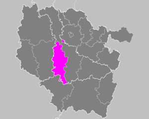
| Beschrijving | Maps of arrondissements and cantons of France: Arrondissement de Toul.PNG | ||
| Datum | |||
| Bron | Eigen werk | ||
| Auteur | M.Minderhoud | ||
| Toestemming (Hergebruik van dit bestand) |
|
Bestandsgeschiedenis
Klik op een datum/tijd om het bestand te zien zoals het destijds was.
| Datum/tijd | Miniatuur | Afmetingen | Gebruiker | Opmerking | |
|---|---|---|---|---|---|
| huidige versie | 16 feb 2010 01:30 | | 850 × 680 (11 kB) | Entlinkt | Exclave fixed, cf. http://www.insee.fr/fr/methodes/nomenclatures/cog/carte_comcan.asp?codecan=5426 |
| 21 nov 2006 19:41 |  | 850 × 680 (31 kB) | Michiel1972 | {{Information |Description= Maps of arrondissements and cantons of France: {{subst:PAGENAME}} |Source= |Date=november 2006 |Author= M.Minderhoud |Permission= {{PD-self}} |other_versions= }} [[Category:Maps of arrondisseme |
Bestandsgebruik
Geen enkele pagina gebruikt dit bestand.
Globaal bestandsgebruik
De volgende andere wiki's gebruiken dit bestand:
- Gebruikt op az.wikipedia.org
- Gebruikt op fa.wikipedia.org
- Gebruikt op it.wikipedia.org
- Gebruikt op lb.wikipedia.org
- Gebruikt op pl.wikipedia.org
- Gebruikt op ro.wikipedia.org
- Gebruikt op ru.wikipedia.org
- Gebruikt op sk.wikipedia.org
- Gebruikt op sl.wikipedia.org