
Bestand:Awaji-island 1.png
Grootte van deze voorvertoning: 544 × 599 pixels. Andere resoluties: 218 × 240 pixels | 436 × 480 pixels | 903 × 995 pixels.
Oorspronkelijk bestand (903 × 995 pixels, bestandsgrootte: 372 kB, MIME-type: image/png)
| Dit is een bestand van Wikimedia Commons. Onderstaande beschrijving komt van de beschrijving van het bestand daar. |
Beschrijving
| Beschrijving |
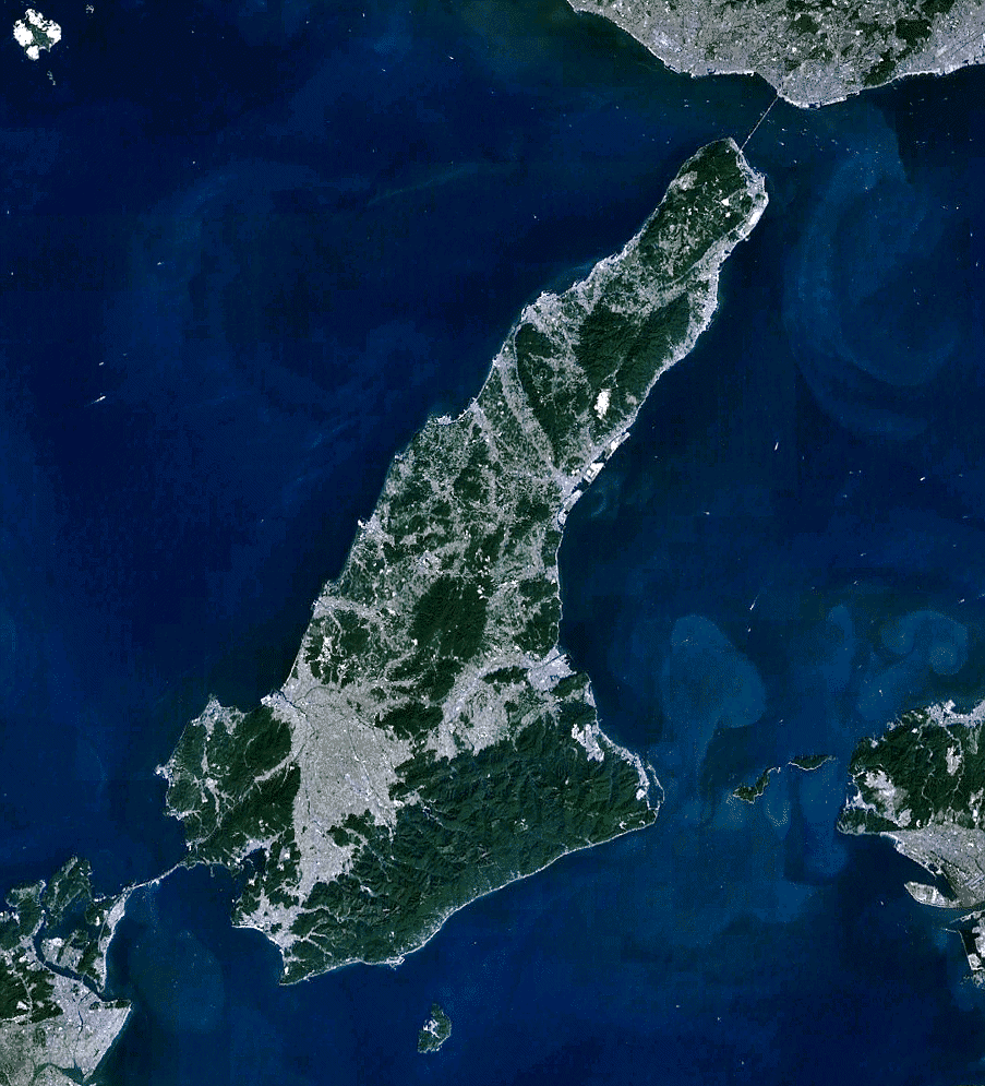
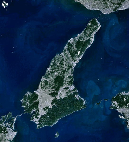
English: the view of Awaji-shima(island), from Landsat, generated on NASA World Wind.
日本語: 衛星ランドサットからの淡路島。NASA World Windで作成。 |
| Datum | |
| Bron | NASA World Wind (http://worldwind.arc.nasa.gov/java/ ) |
| Auteur | Pinqui |
| Andere versies |
|

Licentie
| Deze afbeelding bevindt zich in het publiek domein omdat het een screenshot is van NASA’s software World Wind die gebruik maakt van een publiek domein-laag, zoals Blue Marble, MODIS, Landsat, SRTM, USGS of GLOBE.
|
 |
Bestandsgeschiedenis
Klik op een datum/tijd om het bestand te zien zoals het destijds was.
| Datum/tijd | Miniatuur | Afmetingen | Gebruiker | Opmerking | |
|---|---|---|---|---|---|
| huidige versie | 8 dec 2010 03:28 | | 903 × 995 (372 kB) | Pinqui | {{Information |Description={{en|1=the view of Awaji-shima(island), from Landsat, generated on NASA World Wind.}} {{ja|1=衛星ランドサットからの淡路島。NASA World Windで作成。}} |Source=NASA World Wind (http://worldwind.arc.nasa.gov/java/ |
Bestandsgebruik
Dit bestand wordt op de volgende pagina gebruikt:
Globaal bestandsgebruik
De volgende andere wiki's gebruiken dit bestand:
- Gebruikt op ar.wikipedia.org
- Gebruikt op ca.wikipedia.org
- Gebruikt op ceb.wikipedia.org
- Gebruikt op cs.wikipedia.org
- Gebruikt op de.wikipedia.org
- Gebruikt op en.wikipedia.org
- Gebruikt op en.wikivoyage.org
- Gebruikt op es.wikipedia.org
- Gebruikt op fi.wikipedia.org
- Gebruikt op fr.wikivoyage.org
- Gebruikt op he.wikipedia.org
- Gebruikt op he.wikivoyage.org
- Gebruikt op hy.wikipedia.org
- Gebruikt op incubator.wikimedia.org
- Gebruikt op ja.wikipedia.org
- Gebruikt op ko.wikipedia.org
- Gebruikt op ro.wikipedia.org
- Gebruikt op sl.wikipedia.org
- Gebruikt op th.wikipedia.org
- Gebruikt op uk.wikipedia.org
- Gebruikt op www.wikidata.org