
Bestand:Barahona 71.16445W 18.21020N.jpg

Grootte van deze voorvertoning: 449 × 600 pixels. Andere resoluties: 179 × 240 pixels | 359 × 480 pixels | 958 × 1.280 pixels.
Oorspronkelijk bestand (958 × 1.280 pixels, bestandsgrootte: 223 kB, MIME-type: image/jpeg)
| Dit is een bestand van Wikimedia Commons. Onderstaande beschrijving komt van de beschrijving van het bestand daar. |
Beschrijving
| Beschrijving | |
| Datum | 15 mei 2005 (originele uploaddatum) |
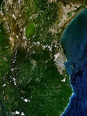
| Bron | NASA World Wind screenshot. |
| Auteur | NASA World Wind screenshot. |
| Deze afbeelding bevindt zich in het publiek domein omdat het een screenshot is van NASA’s software World Wind die gebruik maakt van een publiek domein-laag, zoals Blue Marble, MODIS, Landsat, SRTM, USGS of GLOBE.
|
 |
Bestandsgeschiedenis
Klik op een datum/tijd om het bestand te zien zoals het destijds was.
| Datum/tijd | Miniatuur | Afmetingen | Gebruiker | Opmerking | |
|---|---|---|---|---|---|
| huidige versie | 22 aug 2016 02:01 | | 958 × 1.280 (223 kB) | SteinsplitterBot | Bot: Image rotated by 270° |
| 16 mei 2005 01:14 |  | 1.280 × 958 (222 kB) | Rex | NASA World Wind screenshot. {{PD-USGov-NASA}} Category:Maps of the Dominican Republic |
Bestandsgebruik
Geen enkele pagina gebruikt dit bestand.
Globaal bestandsgebruik
De volgende andere wiki's gebruiken dit bestand:
- Gebruikt op ar.wikipedia.org
- Gebruikt op arz.wikipedia.org
- Gebruikt op ca.wikipedia.org
- Gebruikt op ceb.wikipedia.org
- Gebruikt op de.wikivoyage.org
- Gebruikt op en.wikipedia.org
- Gebruikt op en.wikivoyage.org
- Gebruikt op es.wikipedia.org
- Gebruikt op eu.wikipedia.org
- Gebruikt op fa.wikipedia.org
- Gebruikt op fr.wikipedia.org
- Gebruikt op it.wikipedia.org
- Gebruikt op ko.wikipedia.org
- Gebruikt op mt.wikipedia.org
- Gebruikt op pl.wikipedia.org
- Gebruikt op ru.wikipedia.org
- Gebruikt op simple.wikipedia.org
- Gebruikt op sv.wikipedia.org
- Gebruikt op uk.wikipedia.org
- Gebruikt op ur.wikipedia.org
- Gebruikt op www.wikidata.org
- Gebruikt op zh.wikipedia.org