
Bestand:Bastogne Map December 19-23 1944.jpg
Grootte van deze voorvertoning: 800 × 477 pixels. Andere resoluties: 320 × 191 pixels | 640 × 381 pixels | 1.024 × 610 pixels | 1.556 × 927 pixels.
Oorspronkelijk bestand (1.556 × 927 pixels, bestandsgrootte: 1,19 MB, MIME-type: image/jpeg)
| Dit is een bestand van Wikimedia Commons. Onderstaande beschrijving komt van de beschrijving van het bestand daar. |
Beschrijving
| Beschrijving | ||||||||||
| Datum | ||||||||||
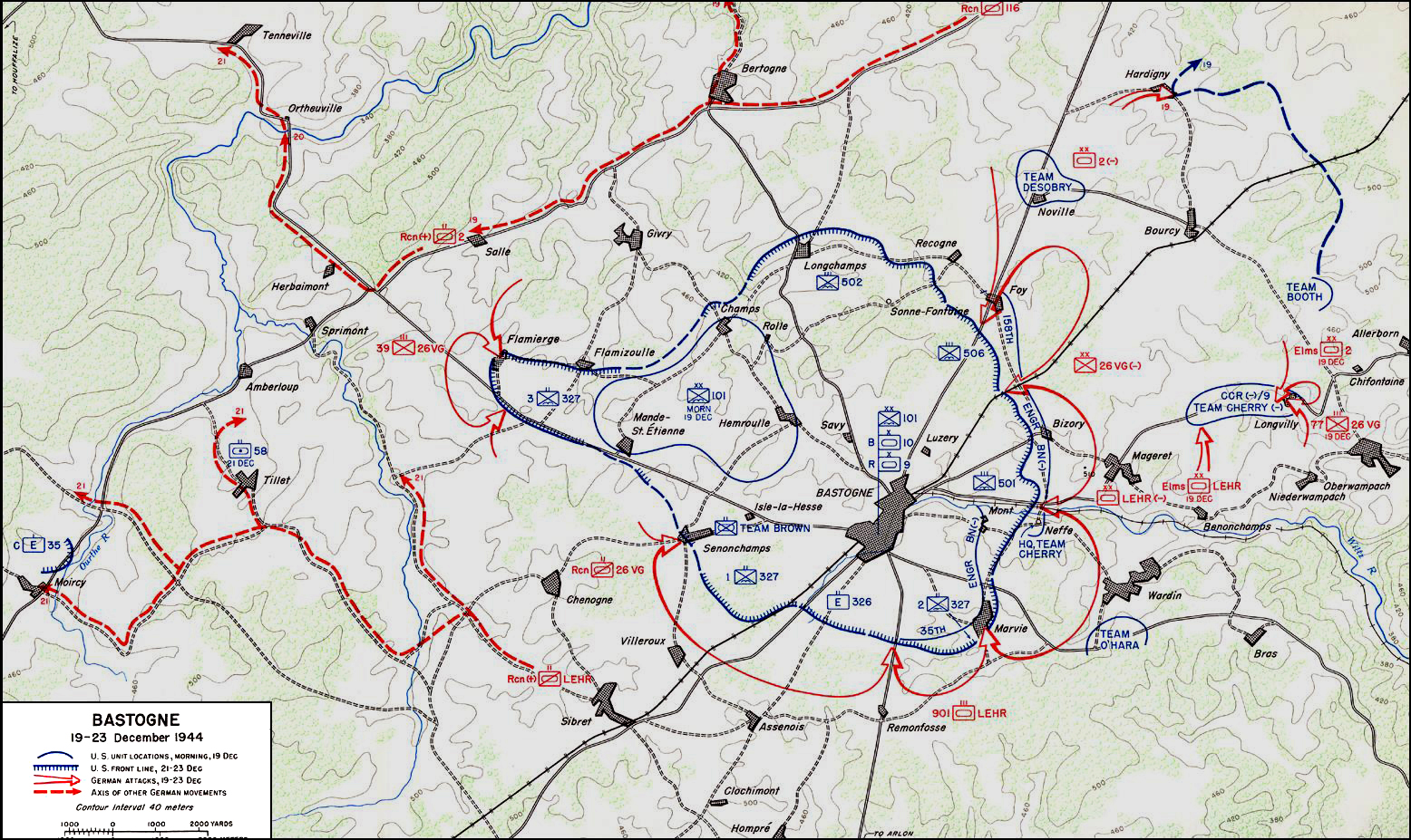
| Bron | United States Army Center of Military History | |||||||||
| Maker | ||||||||||
| Geotemporal data | ||||||||||
| Weergegeven datum | 19 december 1944 tot 23 december 1944 | |||||||||
| Map location | Bastenaken | |||||||||
| Heading |
 |
|||||||||
| Bounding box |
|
|||||||||
| Georeferencing | ||||||||||

|
Deze military map-afbeelding zou opnieuw moeten worden aangemaakt als een SVG-bestand door vectorafbeeldingen te gebruiken. Dit heeft een aantal voordelen; zie Commons:Media for cleanup voor meer informatie. Als er een SVG-formaat van deze afbeelding bestaat, dan deze graag uploaden. Nadat u dit heeft gedaan, gelieve dit sjabloon te vervangen door het sjabloon {{vector version available|nieuwe bestandsnaam.svg}} op deze afbeeldingspagina.
|


Licentie
| This image is in the public domain because it contains materials that originally came from the United States Army Center of Military History, subject to the following qualification.
Note: The images of all badges, insignia, decorations and medals on the "CMH Online" web site are produced by the United States Army Institute of Heraldry and protected by Title 18, United States Code, Section 704 and the Code of Federal Regulations (32 CFR, Part 507). Permission to use these images for commercial purposes must be obtained from The Institute of Heraldry prior to their use. |

|
Bestandsgeschiedenis
Klik op een datum/tijd om het bestand te zien zoals het destijds was.
| Datum/tijd | Miniatuur | Afmetingen | Gebruiker | Opmerking | |
|---|---|---|---|---|---|
| huidige versie | 4 nov 2006 06:59 | | 1.556 × 927 (1,19 MB) | CORNELIUSSEON | {{Information |Description=Bastogne, Belgium Map; december 19-23, 1944. |Source=US Army Center for Military History |Date=December 19-23, 1944 |Author= |Permission={{PD-USGov-Military-Army-USACMH}} – US Army Center for Military History |other_versions= |
Bestandsgebruik
Dit bestand wordt op de volgende 2 pagina's gebruikt:
Globaal bestandsgebruik
De volgende andere wiki's gebruiken dit bestand:
- Gebruikt op ar.wikipedia.org
- Gebruikt op ca.wikipedia.org
- Gebruikt op de.wikipedia.org
- Gebruikt op el.wikipedia.org
- Gebruikt op en.wikipedia.org
- Gebruikt op en.wikisource.org
- Gebruikt op es.wikipedia.org
- Gebruikt op he.wikipedia.org
- Gebruikt op it.wikipedia.org
- Gebruikt op ja.wikipedia.org
- Gebruikt op ru.wikipedia.org
- Gebruikt op sl.wikipedia.org
- Gebruikt op ta.wikipedia.org
- Gebruikt op tr.wikipedia.org
- Gebruikt op www.wikidata.org
- Gebruikt op zh.wikipedia.org