
Bestand:BorahPeakID.jpg
Grootte van deze voorvertoning: 800 × 441 pixels. Andere resoluties: 320 × 176 pixels | 640 × 353 pixels.
Oorspronkelijk bestand (1.089 × 600 pixels, bestandsgrootte: 125 kB, MIME-type: image/jpeg)
| Dit is een bestand van Wikimedia Commons. Onderstaande beschrijving komt van de beschrijving van het bestand daar. |
Beschrijving
| Beschrijving |
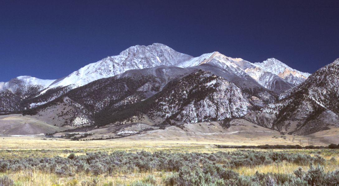
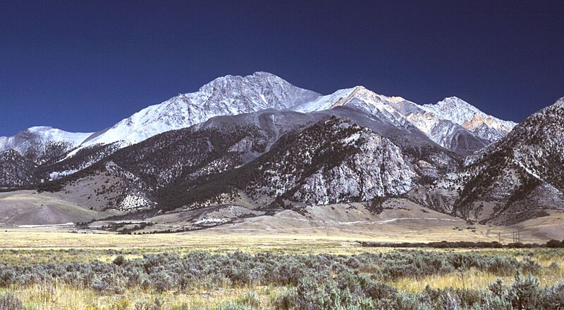
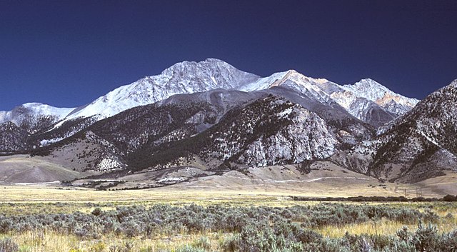
English: Borah Peak, Idaho, looking east. The normal climbing route begins in the wooded canyon at center left. The white line running along the base of the peak is the fault trace from the 1983 earthquake. |
| Datum | 6 mei 2006 (originele uploaddatum) |
| Bron | Verplaatst vanaf en.wikipedia naar Commons door RedWolf met behulp van CommonsHelper. |
| Auteur | G. Thomas op de Engelstalige Wikipedia |
Licentie
| Dit werk vrijgegeven in het publieke domein door de auteur, G. Thomas op de Engelstalige Wikipedia. Dit is wereldwijd van toepassing. In sommige landen is dit wettelijk niet mogelijk; in die gevallen geldt: G. Thomas staat iedereen toe dit werk voor eender welk doel te gebruiken, zonder enige voorwaarden, tenzij zulke voorwaarden door de wet worden voorgeschreven. |
Oorspronkelijk uploadlogboek
De oorspronkelijke beschrijving van deze afbeelding stond hier. Alle volgende gebruikersnamen verwijzen naar en.wikipedia.
- 2006-05-06 20:17 G. Thomas 1089×600× (127941 bytes) Borah Peak, Idaho, looking east. The normal climbing route begins in the wooded canyon at center left. The white line running along the base of the peak is the fault trace from the 1983 earthquake.
Bestandsgeschiedenis
Klik op een datum/tijd om het bestand te zien zoals het destijds was.
| Datum/tijd | Miniatuur | Afmetingen | Gebruiker | Opmerking | |
|---|---|---|---|---|---|
| huidige versie | 21 feb 2009 18:15 | | 1.089 × 600 (125 kB) | RedWolf | {{Information |Description={{en|Borah Peak, Idaho, looking east. The normal climbing route begins in the wooded canyon at center left. The white line running along the base of the peak is the fault trace from the 1983 earthquake.}} |Source=Transferred f |
Bestandsgebruik
Dit bestand wordt op de volgende 2 pagina's gebruikt:
Globaal bestandsgebruik
De volgende andere wiki's gebruiken dit bestand:
- Gebruikt op bg.wikipedia.org
- Gebruikt op cs.wikipedia.org
- Gebruikt op en.wikipedia.org
- List of mountains of the United States
- Borah Peak
- List of U.S. states and territories by elevation
- Lost River Range
- List of the most isolated major summits of the United States
- List of ultras of North America
- List of the most prominent summits of the United States
- List of the major 100-kilometer summits of North America
- Mountain states
- List of the highest major summits of North America
- List of the major 3000-meter summits of the Rocky Mountains
- List of the highest major summits of the United States
- Gebruikt op es.wikipedia.org
- Gebruikt op it.wikipedia.org
- Gebruikt op it.wikivoyage.org
- Gebruikt op pt.wikipedia.org
- Gebruikt op ru.wikipedia.org
- Gebruikt op simple.wikipedia.org
- Gebruikt op uk.wikipedia.org