
Bestand:Carte Tikehau.png

Grootte van deze voorvertoning: 653 × 600 pixels. Andere resoluties: 261 × 240 pixels | 523 × 480 pixels | 836 × 768 pixels | 1.115 × 1.024 pixels | 2.229 × 2.048 pixels | 2.815 × 2.586 pixels.
Oorspronkelijk bestand (2.815 × 2.586 pixels, bestandsgrootte: 159 kB, MIME-type: image/png)
| Dit is een bestand van Wikimedia Commons. Onderstaande beschrijving komt van de beschrijving van het bestand daar. |
Beschrijving
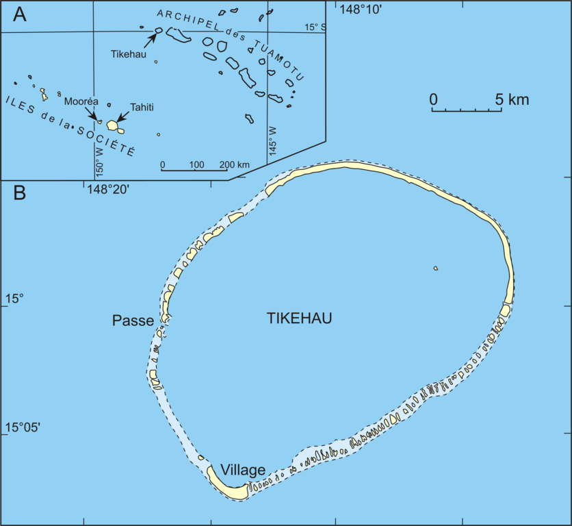
| Beschrijving | Map of the atoll Tikehau (French Polynesia), Carte de l'atoll Tikehau (Polynésie française), Karte vom Atoll Tikehau (Französisch-Polynesien) |
| Datum | |
| Bron | redrawn from scanned maps |
| Auteur | Urs Neumeier |
| Toestemming (Hergebruik van dit bestand) |
Creative Commons Licenses - Attribution Share Alike (by-sa) |
| Andere versies | Image:Carte Tikehau.svg |
Licentie
Dit bestand is gelicenseerd onder de Creative Commons-licentie Naamsvermelding-Gelijk delen 2.5 Unported
- De gebruiker mag:
- Delen – het werk kopiëren, verspreiden en doorgeven
- Remixen – afgeleide werken maken
- Onder de volgende voorwaarden:
- naamsvermelding – U moet op een gepaste manier aan naamsvermelding doen, een link naar de licentie geven, en aangeven of er wijzigingen in het werk zijn aangebracht. U mag dit op elke redelijke manier doen, maar niet zodanig dat de indruk wordt gewekt dat de licentiegever instemt met uw werk of uw gebruik van zijn werk.
- Gelijk delen – Als u het werk heeft geremixt, veranderd, of erop heeft voortgebouwd, moet u het gewijzigde materiaal verspreiden onder dezelfde licentie als het oorspronkelijke werk, of een daarmee compatibele licentie.
Bestandsgeschiedenis
Klik op een datum/tijd om het bestand te zien zoals het destijds was.
| Datum/tijd | Miniatuur | Afmetingen | Gebruiker | Opmerking | |
|---|---|---|---|---|---|
| huidige versie | 31 jul 2007 04:02 | | 2.815 × 2.586 (159 kB) | Neumeier | |
| 13 jan 2006 23:01 |  | 3.753 × 3.449 (153 kB) | Neumeier | {{Information |Description = Map of the atoll Tikehau (French Polynesia), Carte de l'atoll Tikehau (Polynésie française), Karte vom Atoll Tikehau (Französisch-Polynesien) |Source = redrawn from scanned maps |Date = 13.1.2006 |Author = Urs Neumeier |Per |
Bestandsgebruik
Dit bestand wordt op de volgende pagina gebruikt:
Globaal bestandsgebruik
De volgende andere wiki's gebruiken dit bestand: