
Bestand:Chad relief location map.jpg

Grootte van deze voorvertoning: 399 × 599 pixels. Andere resoluties: 160 × 240 pixels | 320 × 480 pixels | 899 × 1.349 pixels.
Oorspronkelijk bestand (899 × 1.349 pixels, bestandsgrootte: 197 kB, MIME-type: image/jpeg)
| Dit is een bestand van Wikimedia Commons. Onderstaande beschrijving komt van de beschrijving van het bestand daar. |
Beschrijving
| Cameralocatie | | Deze en andere afbeeldingen in: OpenStreetMap |
|---|
| Beschrijving |
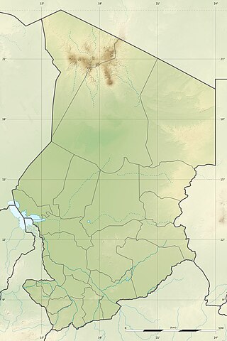
English: Blank physical map of Chad as since the 2008-02 reform of the Regions, for geo-location purposes.
Français : Carte physique vierge du Tchad telle que depuis la réforme des Régions de février 2008, destinée à la géolocalisation. Scale: 1:5,600,000 (precision: 1,400 m)
Geographic limits of the map:
|
||
| Datum | 2009-11, updated 2011-07 | ||
| Bron |
Eigen werk
|
||
| Auteur | Eric Gaba (Sting - fr:Sting) | ||
| Toestemming (Hergebruik van dit bestand) |
|
||
| Andere versies |
|

Licentie
Ik, de auteursrechthebbende van dit werk, maak het hierbij onder de volgende licenties beschikbaar:
Dit bestand is gelicenseerd onder de Creative Commons-licentie Naamsvermelding-Gelijk delen 3.0 Unported
- De gebruiker mag:
- Delen – het werk kopiëren, verspreiden en doorgeven
- Remixen – afgeleide werken maken
- Onder de volgende voorwaarden:
- naamsvermelding – U moet op een gepaste manier aan naamsvermelding doen, een link naar de licentie geven, en aangeven of er wijzigingen in het werk zijn aangebracht. U mag dit op elke redelijke manier doen, maar niet zodanig dat de indruk wordt gewekt dat de licentiegever instemt met uw werk of uw gebruik van zijn werk.
- Gelijk delen – Als u het werk heeft geremixt, veranderd, of erop heeft voortgebouwd, moet u het gewijzigde materiaal verspreiden onder dezelfde licentie als het oorspronkelijke werk, of een daarmee compatibele licentie.

|
Toestemming wordt verleend voor het kopiëren, verspreiden en/of wijzigen van dit document onder de voorwaarden van de GNU-licentie voor vrije documentatie, versie 1.2 of enige latere versie als gepubliceerd door de Free Software Foundation; zonder Invariant Sections, zonder Front-Cover Texts, en zonder Back-Cover Texts. Een kopie van de licentie is opgenomen in de sectie GNU-licentie voor vrije documentatie. |
U mag zelf één van de licenties kiezen.
Bestandsgeschiedenis
Klik op een datum/tijd om het bestand te zien zoals het destijds was.
| Datum/tijd | Miniatuur | Afmetingen | Gebruiker | Opmerking | |
|---|---|---|---|---|---|
| huidige versie | 15 jul 2011 00:21 | | 899 × 1.349 (197 kB) | Sting | Sudan/South Sudan 2011-07 border update |
| 19 jul 2010 15:20 |  | 899 × 1.349 (241 kB) | Sting | Color profile | |
| 24 nov 2009 01:26 |  | 899 × 1.349 (242 kB) | Sting | == {{int:filedesc}} == {{Location|15|27|00|N|18|43|30|E|scale:7000000}} <br/> {{Information |Description={{en|Blank physical map of Chad as after the 2008-02 reform of the Regions, for geo-location purposes.}} {{fr|Carte physique vierge du [[ |
Bestandsgebruik
Dit bestand wordt op de volgende 5 pagina's gebruikt:
Globaal bestandsgebruik
De volgende andere wiki's gebruiken dit bestand:
- Gebruikt op ar.wikipedia.org
- Gebruikt op azb.wikipedia.org
- Gebruikt op az.wikipedia.org
- Gebruikt op ban.wikipedia.org
- Gebruikt op ba.wikipedia.org
- Gebruikt op bcl.wikipedia.org
- Gebruikt op be-tarask.wikipedia.org
- Gebruikt op be.wikipedia.org
- Gebruikt op bg.wikipedia.org
Globaal gebruik van dit bestand bekijken.