
Bestand:Chornobyl radiation map.jpg
Grootte van deze voorvertoning: 556 × 600 pixels. Andere resoluties: 222 × 240 pixels | 445 × 480 pixels | 712 × 768 pixels | 1.070 × 1.154 pixels.
Oorspronkelijk bestand (1.070 × 1.154 pixels, bestandsgrootte: 237 kB, MIME-type: image/jpeg)
| Dit is een bestand van Wikimedia Commons. Onderstaande beschrijving komt van de beschrijving van het bestand daar. |
Beschrijving
| Beschrijving |
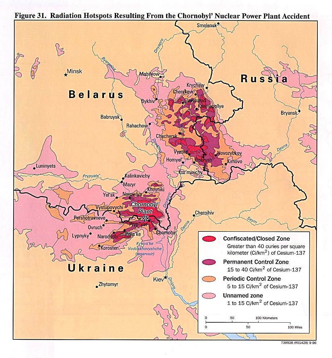
中文:切尔诺贝利核电站事故后周边地区受到核辐射的剂量示意图。 |
| Datum | |
| Bron |
English: "Courtesy of the University of Texas Libraries, The University of Texas at Austin." See [1]; from the CIA Handbook of International Economic Statistics
|
| Auteur | |
| Andere versies |
[]
|


.svg)


Licentie
| This image is a work of a Central Intelligence Agency employee, taken or made as part of that person's official duties. As a Work of the United States Government, this image or media is in the public domain in the United States.
|

|
Bestandsgeschiedenis
Klik op een datum/tijd om het bestand te zien zoals het destijds was.
| Datum/tijd | Miniatuur | Afmetingen | Gebruiker | Opmerking | |
|---|---|---|---|---|---|
| huidige versie | 25 dec 2005 23:32 | | 1.070 × 1.154 (237 kB) | Redline | "Courtesy of the University of Texas Libraries, The University of Texas at Austin." See [http://www.lib.utexas.edu/maps/belarus.html]; from the CIA Handbook of International Economic Statistics. 1996 {{PD-USGov}} |
Bestandsgebruik
Dit bestand wordt op de volgende pagina gebruikt:
Globaal bestandsgebruik
De volgende andere wiki's gebruiken dit bestand:
- Gebruikt op de.wikipedia.org
- Gebruikt op en.wikinews.org
- Gebruikt op he.wikipedia.org
- Gebruikt op ja.wikipedia.org
- Gebruikt op kn.wikipedia.org
- Gebruikt op sh.wikipedia.org
- Gebruikt op vi.wikipedia.org
- Gebruikt op zh.wikipedia.org