
Bestand:Clark County Nevada Incorporated Areas Henderson highlighted.svg

Afmetingen van deze voorvertoning van het type PNG van dit SVG-bestand: 538 × 599 pixels Andere resoluties: 215 × 240 pixels | 431 × 480 pixels | 689 × 768 pixels | 919 × 1.024 pixels | 1.838 × 2.048 pixels | 700 × 780 pixels.
Oorspronkelijk bestand (SVG-bestand, nominaal 700 × 780 pixels, bestandsgrootte: 139 kB)
| Dit is een bestand van Wikimedia Commons. Onderstaande beschrijving komt van de beschrijving van het bestand daar. |
Beschrijving
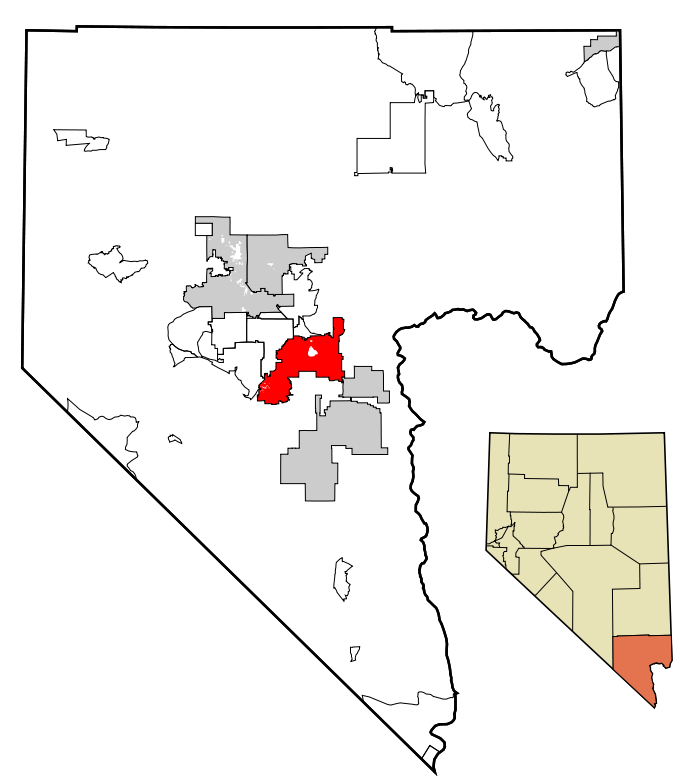
| Beschrijving | This map shows the incorporated areas in Clark County, Nevada. Henderson is highlighted in red. I created it in Inkscape using data from the following files: Census 2000 Block Map - Clark County (PDF) and Southern Nevada Public Lands Management Act Map (PDF) |
| Datum | |
| Bron | My own work, based on government information. Though I strove to be as accurate in the detail as possible, the information shown is not guaranteed to be completely accurate. |
| Auteur | Ixnayonthetimmay |
| Toestemming (Hergebruik van dit bestand) |
Public Domain |
| Andere versies | See Category:Maps of Clark County, Nevada for other versions of this image. |
Licentie
| Ik, de auteursrechthebbende van dit werk, geef dit werk vrij in het publieke domein. Dit is wereldwijd van toepassing. In sommige landen is dit wettelijk niet mogelijk; in die gevallen geldt: Ik sta iedereen toe dit werk voor eender welk doel te gebruiken, zonder enige voorwaarden, tenzij zulke voorwaarden door de wet worden voorgeschreven. |
Bestandsgeschiedenis
Klik op een datum/tijd om het bestand te zien zoals het destijds was.
| Datum/tijd | Miniatuur | Afmetingen | Gebruiker | Opmerking | |
|---|---|---|---|---|---|
| huidige versie | 18 jul 2007 03:08 | | 700 × 780 (139 kB) | Ixnayonthetimmay | == Summary == {{Information |Description=This map shows the incorporated areas in Clark County, Nevada. Henderson is highlighted in red. I created it in [[en:Inksca |
Bestandsgebruik
Dit bestand wordt op de volgende pagina gebruikt:
Globaal bestandsgebruik
De volgende andere wiki's gebruiken dit bestand:
- Gebruikt op ang.wikipedia.org
- Gebruikt op ar.wikipedia.org
- Gebruikt op arz.wikipedia.org
- Gebruikt op azb.wikipedia.org
- Gebruikt op br.wikipedia.org
- Gebruikt op ca.wikipedia.org
- Gebruikt op ceb.wikipedia.org
- Gebruikt op de.wikipedia.org
- Gebruikt op el.wikipedia.org
- Gebruikt op en.wikipedia.org
- Gebruikt op eo.wikipedia.org
- Gebruikt op eu.wikipedia.org
- Gebruikt op fa.wikipedia.org
- Gebruikt op fi.wikipedia.org
- Gebruikt op fr.wikipedia.org
- Gebruikt op ga.wikipedia.org
- Gebruikt op gd.wikipedia.org
- Gebruikt op gl.wikipedia.org
- Gebruikt op he.wikipedia.org
- Gebruikt op ht.wikipedia.org
- Gebruikt op id.wikipedia.org
- Gebruikt op it.wikipedia.org
- Gebruikt op ja.wikipedia.org
- Gebruikt op kw.wikipedia.org
- Gebruikt op pl.wikipedia.org
- Gebruikt op pl.wikivoyage.org
- Gebruikt op pms.wikipedia.org
- Gebruikt op pt.wikipedia.org
- Gebruikt op ro.wikipedia.org
- Gebruikt op sco.wikipedia.org
- Gebruikt op sc.wikipedia.org
- Gebruikt op sh.wikipedia.org
- Gebruikt op simple.wikipedia.org
- Gebruikt op sr.wikipedia.org
- Gebruikt op ta.wikipedia.org
- Gebruikt op tt.wikipedia.org
- Gebruikt op ur.wikipedia.org
- Gebruikt op vi.wikipedia.org
- Gebruikt op vo.wikipedia.org
- Gebruikt op www.wikidata.org
- Gebruikt op zh.wikipedia.org