
Bestand:Comoros location map Topographic.png

Grootte van deze voorvertoning: 745 × 600 pixels. Andere resoluties: 298 × 240 pixels | 596 × 480 pixels | 954 × 768 pixels | 1.272 × 1.024 pixels | 1.835 × 1.477 pixels.
Oorspronkelijk bestand (1.835 × 1.477 pixels, bestandsgrootte: 684 kB, MIME-type: image/png)
| Dit is een bestand van Wikimedia Commons. Onderstaande beschrijving komt van de beschrijving van het bestand daar. |
Beschrijving
| Beschrijving |
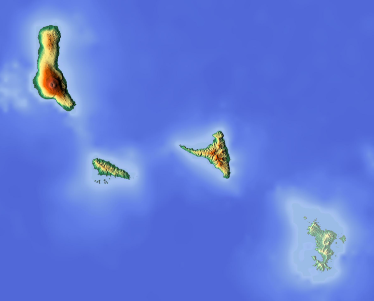
Deutsch: Positionskarte der Komoren
Quadratische Plattkarte. Geographische Begrenzung der Karte:
English: Location map of the Comoros
Equirectangular projection. Geographic limits of the map:
|
| Datum | |
| Bron | Eigen werk (backgroung : http://www.maps-for-free.com) |
| Auteur | Dr Brains |
Licentie
Ik, de auteursrechthebbende van dit werk, maak het hierbij onder de volgende licenties beschikbaar:

|
Toestemming wordt verleend voor het kopiëren, verspreiden en/of wijzigen van dit document onder de voorwaarden van de GNU-licentie voor vrije documentatie, alleen versie 1.2 als gepubliceerd door de Free Software Foundation; zonder Invariant Sections, zonder Front-Cover Texts, en zonder Back-Cover Texts. Een kopie van de licentie is opgenomen in de sectie GNU-licentie voor vrije documentatie. | alleen 1.2 |
|
|
Toestemming wordt verleend voor het kopiëren, verspreiden en/of wijzigen van dit document onder de voorwaarden van de GNU-licentie voor vrije documentatie, versie 1.3 of enige latere versie als gepubliceerd door de Free Software Foundation; zonder Invariant Sections, zonder Front-Cover Texts, en zonder Back-Cover Texts. Een kopie van de licentie is opgenomen in de sectie GNU-licentie voor vrije documentatie.
|
U mag zelf één van de licenties kiezen.
Bestandsgeschiedenis
Klik op een datum/tijd om het bestand te zien zoals het destijds was.
| Datum/tijd | Miniatuur | Afmetingen | Gebruiker | Opmerking | |
|---|---|---|---|---|---|
| huidige versie | 12 jun 2018 13:14 | | 1.835 × 1.477 (684 kB) | Larske | Cropped to have the same longitude and latitude limits as the file Comoros location map.svg |
| 15 jun 2012 20:50 |  | 2.000 × 1.589 (705 kB) | Dr Brains |
Bestandsgebruik
Dit bestand wordt op de volgende 5 pagina's gebruikt:
Globaal bestandsgebruik
De volgende andere wiki's gebruiken dit bestand:
- Gebruikt op ar.wikipedia.org
- Gebruikt op ast.wikipedia.org
- Gebruikt op bg.wikipedia.org
- Gebruikt op bn.wikipedia.org
- Gebruikt op bs.wikipedia.org
- Gebruikt op ca.wikipedia.org
- Gebruikt op ceb.wikipedia.org
- Gebruikt op el.wikipedia.org
- Gebruikt op en.wikipedia.org
- Gebruikt op fa.wikipedia.org
- Gebruikt op fr.wikipedia.org
- Anjouan
- Mohéli
- Karthala
- Grande Comore
- Combat d'Anjouan
- Parc marin de Mohéli
- Modèle:Géolocalisation/Comores
- La Grille
- Projet:Cartographie/Géolocalisation/Maintenance/Images des pays
- Lac Dzialandzé
- Modèle:Géolocalisation/Comores/Documentation
- Lac Niamawi
- Mont Ntringui
- Dar-Salama Mbadjini
- Fani Maoré
- Moindzaza Mboini
- Gebruikt op he.wikipedia.org
- Gebruikt op hr.wikipedia.org
- Gebruikt op hsb.wikipedia.org
- Gebruikt op hy.wikipedia.org
- Gebruikt op ja.wikipedia.org
- Gebruikt op kn.wikipedia.org
Globaal gebruik van dit bestand bekijken.