
Bestand:Crawley Neighbourhoods (West Green).png
Geen hogere resolutie beschikbaar.
Crawley_Neighbourhoods_(West_Green).png (260 × 277 pixels, bestandsgrootte: 7 kB, MIME-type: image/png)
| Dit is een bestand van Wikimedia Commons. Onderstaande beschrijving komt van de beschrijving van het bestand daar. |
.png)
Beschrijving
| Beschrijving |
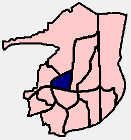
English: PNG diagram of the Crawley Borough area (in West Sussex, England), showing the 13 residential neighbourhoods and highlighting West Green in dark blue. (Each neighbourhood was allocated a colour when it was built, which together with its name is used on street name signs. Dark blue is West Green's official colour.) |
| Datum | |
| Bron | Eigen werk |
| Auteur | The Voice of Hassocks |
Licentie
| Ik, de auteursrechthebbende van dit werk, geef dit werk vrij in het publieke domein. Dit is wereldwijd van toepassing. In sommige landen is dit wettelijk niet mogelijk; in die gevallen geldt: Ik sta iedereen toe dit werk voor eender welk doel te gebruiken, zonder enige voorwaarden, tenzij zulke voorwaarden door de wet worden voorgeschreven. |
Bestandsgeschiedenis
Klik op een datum/tijd om het bestand te zien zoals het destijds was.
| Datum/tijd | Miniatuur | Afmetingen | Gebruiker | Opmerking | |
|---|---|---|---|---|---|
| huidige versie | 22 feb 2009 21:31 | | 260 × 277 (7 kB) | Hassocks5489 | {{Information |Description={{en|1=PNG diagram of the Crawley Borough area (in West Sussex, England), showing the 13 residential neighbourhoods and highlighting West Green in dark blue. (Each neighbourhood was allocated a colour when it was built, which t |
Bestandsgebruik
Dit bestand wordt op de volgende pagina gebruikt:
Globaal bestandsgebruik
De volgende andere wiki's gebruiken dit bestand:
- Gebruikt op en.wikipedia.org
.png)