
Bestand:Deutsch Ostafrika.PNG

Oorspronkelijk bestand (701 × 764 pixels, bestandsgrootte: 1,32 MB, MIME-type: image/png)
| Dit is een bestand van Wikimedia Commons. Onderstaande beschrijving komt van de beschrijving van het bestand daar. |
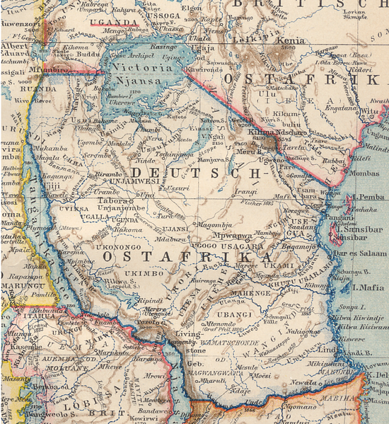
Beschrijving
| Beschrijving | Map of German East Africa (March 1894) |
| Datum | |
| Bron | Brockhaus atlas (1894) |
| Auteur |
Licentie
|
Dit werk bevindt zich in het publiek domein in landen en gebieden waar de auteursrechttermijn het leven van de auteur plus 70 jaar of minder is.
| |
| Van dit bestand is vastgesteld dat er geen bekende auteursrechtaanspraken op rusten, alle aanverwante en naburige rechten daarbij inbegrepen. | |
Bestandsgeschiedenis
Klik op een datum/tijd om het bestand te zien zoals het destijds was.
| Datum/tijd | Miniatuur | Afmetingen | Gebruiker | Opmerking | |
|---|---|---|---|---|---|
| huidige versie | 8 jul 2007 15:05 | | 701 × 764 (1,32 MB) | Ivan1111 | {{Information |Description= Map of German East Africa (March 1894) |Source= Brockhaus atlas (1894) |Date= March 1894 |Author= |Permission= |other_versions= }} |
Bestandsgebruik
Dit bestand wordt op de volgende 2 pagina's gebruikt:
Globaal bestandsgebruik
De volgende andere wiki's gebruiken dit bestand:
- Gebruikt op ca.wikipedia.org
- Gebruikt op en.wikipedia.org
- Gebruikt op es.wikipedia.org
- Gebruikt op fi.wikipedia.org
- Gebruikt op fr.wikipedia.org
- Gebruikt op he.wikipedia.org
- Gebruikt op mt.wikipedia.org
- Gebruikt op ru.wikipedia.org
- Gebruikt op sw.wikipedia.org