
Bestand:Guadalcanal Topography.png
Grootte van deze voorvertoning: 800 × 546 pixels. Andere resoluties: 320 × 218 pixels | 640 × 437 pixels | 1.024 × 699 pixels | 1.280 × 873 pixels | 2.244 × 1.531 pixels.
Oorspronkelijk bestand (2.244 × 1.531 pixels, bestandsgrootte: 1,68 MB, MIME-type: image/png)
| Dit is een bestand van Wikimedia Commons. Onderstaande beschrijving komt van de beschrijving van het bestand daar. |
Beschrijving
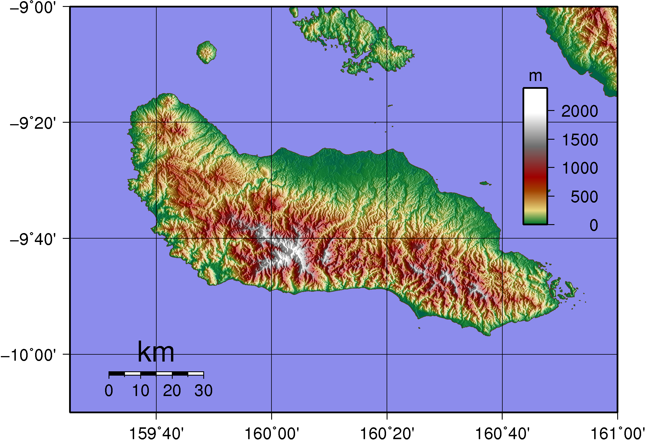
| Beschrijving | Topographic Map of Guadalcanal |
| Datum | |
| Bron | Created with GMT from publicly released SRTM data |
| Auteur | Sadalmelik |
Licentie
| Ik, de auteursrechthebbende van dit werk, geef dit werk vrij in het publieke domein. Dit is wereldwijd van toepassing. In sommige landen is dit wettelijk niet mogelijk; in die gevallen geldt: Ik sta iedereen toe dit werk voor eender welk doel te gebruiken, zonder enige voorwaarden, tenzij zulke voorwaarden door de wet worden voorgeschreven. |
Bestandsgeschiedenis
Klik op een datum/tijd om het bestand te zien zoals het destijds was.
| Datum/tijd | Miniatuur | Afmetingen | Gebruiker | Opmerking | |
|---|---|---|---|---|---|
| huidige versie | 2 jun 2007 22:27 | | 2.244 × 1.531 (1,68 MB) | Sadalmelik | {{Information |Description=Topographic Map of Guadalcanal |Source=Created with GMT from publicly released SRTM data |Date=June 2, 2007 |Author= User:Sadalmelik }} Maps of the Solomon Islands |
Bestandsgebruik
Dit bestand wordt op de volgende pagina gebruikt:
Globaal bestandsgebruik
De volgende andere wiki's gebruiken dit bestand:
- Gebruikt op az.wikipedia.org
- Gebruikt op de.wikipedia.org
- Gebruikt op en.wikipedia.org
- Gebruikt op et.wikipedia.org
- Gebruikt op eu.wikipedia.org
- Gebruikt op gl.wikipedia.org
- Gebruikt op he.wikipedia.org
- Gebruikt op ja.wikipedia.org
- Gebruikt op ka.wikipedia.org
- Gebruikt op lt.wikipedia.org
- Gebruikt op no.wikipedia.org
- Gebruikt op ru.wikipedia.org
- Gebruikt op simple.wikipedia.org
- Gebruikt op sk.wikipedia.org
- Gebruikt op uk.wikipedia.org