
Bestand:Helen Reef.png
Grootte van deze voorvertoning: 359 × 598 pixels. Andere resoluties: 144 × 240 pixels | 288 × 480 pixels | 892 × 1.487 pixels.
Oorspronkelijk bestand (892 × 1.487 pixels, bestandsgrootte: 90 kB, MIME-type: image/png)
| Dit is een bestand van Wikimedia Commons. Onderstaande beschrijving komt van de beschrijving van het bestand daar. |
Beschrijving
| Beschrijving |
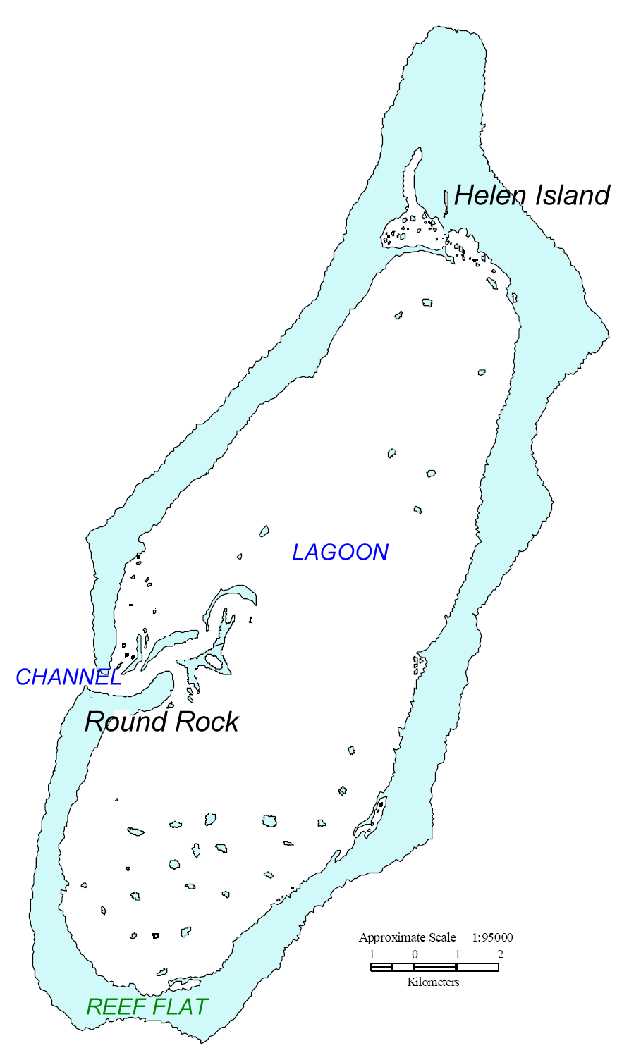
English: Map of Helen Reef, Palau. Based on map from U.S. Minerals Management Service. |
| Datum | |
| Bron | original source: http://tobi.gmu.edu/thisisnow/Helen%20Reef%202000%20Monitoring%20Expedition.pdf, processed by Ratzer. |
| Auteur | U.S. Minerals Management Service |
Licentie
| This article or image contains material based on a work of a Minerals Management Service employee, created as part of that person's official duties. As a work of the U.S. federal government, such work is in the public domain in the United States. See MMS Disclaimer. |  |
Oorspronkelijk uploadlogboek
| date/time | username | Dimensions | File Size | edit summary |
|---|---|---|---|---|
| 11:46, 17 July 2006 | Ratzer | 892×1487 | 90 KB | base map from U.S. Minerals Management Service, Mapping and Boundary Branch (as explained on page http://cas.gmu.edu/~tobi/thisisnow/Helen%20Reef%202000%20Monitoring%20Expedition.pdf), processed by me |
Bestandsgeschiedenis
Klik op een datum/tijd om het bestand te zien zoals het destijds was.
| Datum/tijd | Miniatuur | Afmetingen | Gebruiker | Opmerking | |
|---|---|---|---|---|---|
| huidige versie | 2 mei 2008 12:04 | | 892 × 1.487 (90 kB) | Telim tor | == Information == {{Information |Description=Map of Helen Reef, Palau. Based on map from U.S. Minerals Management Service Boundary Branch |Source=original source: http://cas.gmu.edu/~tobi/thisisnow/Helen%20Reef%202000%20Monitoring%20Expedition.pdf Proce |
Bestandsgebruik
Dit bestand wordt op de volgende 2 pagina's gebruikt:
Globaal bestandsgebruik
De volgende andere wiki's gebruiken dit bestand:
- Gebruikt op az.wikipedia.org
- Gebruikt op ca.wikipedia.org
- Gebruikt op de.wikipedia.org
- Gebruikt op en.wikipedia.org
- Gebruikt op es.wikipedia.org
- Gebruikt op ja.wikipedia.org
- Gebruikt op lt.wikipedia.org
- Gebruikt op mk.wikipedia.org
- Gebruikt op ru.wikipedia.org
- Gebruikt op www.wikidata.org