
Bestand:Jamaica relief location map.jpg

Grootte van deze voorvertoning: 800 × 385 pixels. Andere resoluties: 320 × 154 pixels | 640 × 308 pixels | 1.024 × 493 pixels | 1.870 × 900 pixels.
Oorspronkelijk bestand (1.870 × 900 pixels, bestandsgrootte: 594 kB, MIME-type: image/jpeg)
| Dit is een bestand van Wikimedia Commons. Onderstaande beschrijving komt van de beschrijving van het bestand daar. |
| Beschrijving |
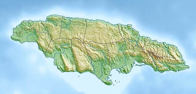
Deutsch: Physische Positionskarte von Jamaika
Quadratische Plattkarte, N-S-Streckung 105 %. Geographische Begrenzung der Karte:
English: Physical location map of Jamaica
Equirectangular projection, N/S stretching 105 %. Geographic limits of the map:
|
| Datum | |
| Bron | Eigen werk, using map data from administrative map by NordNordWest. The relief was created from SRTM-3 relief data |
| Auteur | Carport |
| Toestemming (Hergebruik van dit bestand) |
Dit bestand is gelicenseerd onder de Creative Commons-licentie Naamsvermelding-Gelijk delen 3.0 Unported
|
| Andere versies |
|

Bestandsgeschiedenis
Klik op een datum/tijd om het bestand te zien zoals het destijds was.
| Datum/tijd | Miniatuur | Afmetingen | Gebruiker | Opmerking | |
|---|---|---|---|---|---|
| huidige versie | 1 apr 2010 17:59 | | 1.870 × 900 (594 kB) | Carport | {{Information |Description={{de|Physische Positionskarte von {{w|Jamaika|3=de}}}} Quadratische Plattkarte, N-S-Streckung 105 %. Geographische Begrenzung der Karte: * N: 18.7° N * S: 17.6° N * W: 78.5° W * O: 76.1° W {{en|Physical location map of {{w|J |
Bestandsgebruik
Dit bestand wordt op de volgende 3 pagina's gebruikt:
Globaal bestandsgebruik
De volgende andere wiki's gebruiken dit bestand:
- Gebruikt op ar.wikipedia.org
- Gebruikt op arz.wikipedia.org
- Gebruikt op ast.wikipedia.org
- Gebruikt op az.wikipedia.org
- Gebruikt op be.wikipedia.org
- Gebruikt op bg.wikipedia.org
- Gebruikt op bn.wikipedia.org
- Gebruikt op bs.wikipedia.org
- Gebruikt op ca.wikipedia.org
- Gebruikt op ceb.wikipedia.org
- Gebruikt op ce.wikipedia.org
- Gebruikt op ckb.wikipedia.org
- Gebruikt op cs.wikipedia.org
- Gebruikt op da.wikipedia.org
- Gebruikt op de.wikipedia.org
- Gebruikt op de.wikivoyage.org
Globaal gebruik van dit bestand bekijken.