Bestand:JulArcticSfcT.svg
Uiterlijk

Afmetingen van deze voorvertoning van het type PNG van dit SVG-bestand: 648 × 600 pixels Andere resoluties: 259 × 240 pixels | 519 × 480 pixels | 830 × 768 pixels | 1.107 × 1.024 pixels | 2.213 × 2.048 pixels | 778 × 720 pixels.
Oorspronkelijk bestand (SVG-bestand, nominaal 778 × 720 pixels, bestandsgrootte: 472 kB)
Bestandsgeschiedenis
Klik op een datum/tijd om het bestand te zien zoals het destijds was.
| Datum/tijd | Miniatuur | Afmetingen | Gebruiker | Opmerking | |
|---|---|---|---|---|---|
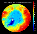
| huidige versie | 9 sep 2007 02:38 |  | 778 × 720 (472 kB) | StephenHudson | == Summary == {{Information |Description=This map shows the mean surface air temperature (2 meters above the surface) over the Arctic in July, from NCEP/NCAR Reanalysis data from 1968 to 1996. |Source=Produced at http://www.cdc.noaa.gov/cgi-bin/DataMenus. |
Bestandsgebruik
Dit bestand wordt op de volgende pagina gebruikt:
Globaal bestandsgebruik
De volgende andere wiki's gebruiken dit bestand:
- Gebruikt op az.wikipedia.org
- Gebruikt op en.wikipedia.org
- Gebruikt op fa.wikipedia.org
- Gebruikt op fr.wikipedia.org
- Gebruikt op hy.wikipedia.org
- Gebruikt op id.wikipedia.org

