
Bestand:LocationHungaryInterbellum.png
Geen hogere resolutie beschikbaar.
LocationHungaryInterbellum.png (248 × 113 pixels, bestandsgrootte: 6 kB, MIME-type: image/png)
| Dit is een bestand van Wikimedia Commons. Onderstaande beschrijving komt van de beschrijving van het bestand daar. |
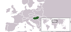
Beschrijving
| Beschrijving | Location of Hungary during 1920s and 1930s |
| Bron | based on Image:LocationCzechoslovakia.png |
| Auteur | Hanhil |
Licentie
| Ik, de auteursrechthebbende van dit werk, geef dit werk vrij in het publieke domein. Dit is wereldwijd van toepassing. In sommige landen is dit wettelijk niet mogelijk; in die gevallen geldt: Ik sta iedereen toe dit werk voor eender welk doel te gebruiken, zonder enige voorwaarden, tenzij zulke voorwaarden door de wet worden voorgeschreven. |
Bestandsgeschiedenis
Klik op een datum/tijd om het bestand te zien zoals het destijds was.
| Datum/tijd | Miniatuur | Afmetingen | Gebruiker | Opmerking | |
|---|---|---|---|---|---|
| huidige versie | 20 apr 2008 09:59 | | 248 × 113 (6 kB) | Hanhil | {{Information |Description=Location of Hungary during 1920s and 1930s |Source=based on Image:LocationCzechoslovakia.png |Date= |Author= Hanhil |Permission= |other_versions= }} Category:Maps of the history of Hungary |
Bestandsgebruik
Dit bestand wordt op de volgende pagina gebruikt:
Globaal bestandsgebruik
De volgende andere wiki's gebruiken dit bestand:
- Gebruikt op ca.wikipedia.org
- Gebruikt op hr.wikipedia.org
- Gebruikt op rue.wikipedia.org