
Bestand:Location of the province Abancay in Apurímac.svg

Afmetingen van deze voorvertoning van het type PNG van dit SVG-bestand: 456 × 599 pixels Andere resoluties: 182 × 240 pixels | 365 × 480 pixels | 584 × 768 pixels | 779 × 1.024 pixels | 1.558 × 2.048 pixels | 490 × 644 pixels.
Oorspronkelijk bestand (SVG-bestand, nominaal 490 × 644 pixels, bestandsgrootte: 195 kB)
| Dit is een bestand van Wikimedia Commons. Onderstaande beschrijving komt van de beschrijving van het bestand daar. |
Beschrijving
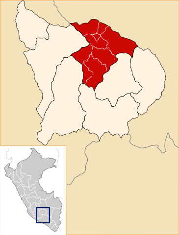
| Beschrijving | Location of the province Abancay in the Apurímac region in Peru (Map) |
| Datum | |
| Bron | Eigen werk |
| Auteur | AgainErick |
| Toestemming (Hergebruik van dit bestand) |
GFDL |
Licentie
Ik, de auteursrechthebbende van dit werk, maak het hierbij onder de volgende licenties beschikbaar:

|
Toestemming wordt verleend voor het kopiëren, verspreiden en/of wijzigen van dit document onder de voorwaarden van de GNU-licentie voor vrije documentatie, versie 1.2 of enige latere versie als gepubliceerd door de Free Software Foundation; zonder Invariant Sections, zonder Front-Cover Texts, en zonder Back-Cover Texts. Een kopie van de licentie is opgenomen in de sectie GNU-licentie voor vrije documentatie. |
| Dit bestand is gelicenseerd onder de Creative Commons-licentie Naamsvermelding-Gelijk delen 3.0 Unported | ||
| ||
| Deze licentietag is toegevoegd aan dit bestand in verband met de GFDL licentie-update. |
Dit bestand is gelicenseerd onder de Creative Commons-licenties Naamsvermelding-Gelijk delen 2.5 Algemeen, 2.0 Algemeen en 1.0 Algemeen.
- De gebruiker mag:
- Delen – het werk kopiëren, verspreiden en doorgeven
- Remixen – afgeleide werken maken
- Onder de volgende voorwaarden:
- naamsvermelding – U moet op een gepaste manier aan naamsvermelding doen, een link naar de licentie geven, en aangeven of er wijzigingen in het werk zijn aangebracht. U mag dit op elke redelijke manier doen, maar niet zodanig dat de indruk wordt gewekt dat de licentiegever instemt met uw werk of uw gebruik van zijn werk.
- Gelijk delen – Als u het werk heeft geremixt, veranderd, of erop heeft voortgebouwd, moet u het gewijzigde materiaal verspreiden onder dezelfde licentie als het oorspronkelijke werk, of een daarmee compatibele licentie.
U mag zelf één van de licenties kiezen.
Bestandsgeschiedenis
Klik op een datum/tijd om het bestand te zien zoals het destijds was.
| Datum/tijd | Miniatuur | Afmetingen | Gebruiker | Opmerking | |
|---|---|---|---|---|---|
| huidige versie | 28 jul 2008 21:48 | | 490 × 644 (195 kB) | AgainErick | New version including mini-locator map for province within peru. |
| 12 apr 2007 02:51 |  | 300 × 287 (40 kB) | AgainErick | {Information |Description=Location of the province Abancay in the Apurímac region in Peru (Map) |Source=own work |Date=april 12 2007 |Author=Eric Bronder |Permission=GFDL |other_versions= }} Apurímac |
Bestandsgebruik
Dit bestand wordt op de volgende pagina gebruikt:
Globaal bestandsgebruik
De volgende andere wiki's gebruiken dit bestand:
- Gebruikt op ay.wikipedia.org
- Gebruikt op de.wikipedia.org
- Gebruikt op en.wikipedia.org
- Gebruikt op es.wikipedia.org
- Provincia de Abancay
- Distrito de Abancay
- Distrito de Circa
- Distrito de Huanipaca
- Distrito de Lambrama
- Distrito de Pichirhua
- Distrito de San Pedro de Cachora
- Distrito de Tamburco
- Distrito de Mariscal Gamarra
- Distrito de Santa Rosa (Grau)
- Distrito de San Antonio (Grau)
- Distrito de Chuquibambilla
- Distrito de Curpahuasi
- Distrito de Curasco
- Distrito de Curahuasi
- Gobierno Regional de Apurímac
- Elecciones regionales de Apurímac de 2010
- Elecciones regionales de Apurímac de 2014
- Gebruikt op fa.wikipedia.org
- Gebruikt op fr.wikipedia.org
- Gebruikt op incubator.wikimedia.org
- Gebruikt op it.wikipedia.org
- Gebruikt op ka.wikipedia.org
- Gebruikt op lt.wikipedia.org
- Gebruikt op no.wikipedia.org
- Gebruikt op pl.wikipedia.org
- Gebruikt op pt.wikipedia.org
Globaal gebruik van dit bestand bekijken.