
Bestand:Locator Duchy of Jülich (1560).svg

Afmetingen van deze voorvertoning van het type PNG van dit SVG-bestand: 800 × 530 pixels Andere resoluties: 320 × 212 pixels | 640 × 424 pixels | 1.024 × 678 pixels | 1.280 × 848 pixels | 2.560 × 1.695 pixels | 5.029 × 3.330 pixels.
Oorspronkelijk bestand (SVG-bestand, nominaal 5.029 × 3.330 pixels, bestandsgrootte: 570 kB)
Dit is een bestand van Wikimedia Commons.
Onderstaande beschrijving komt van de beschrijving van het bestand daar.
Onderstaande beschrijving komt van de beschrijving van het bestand daar.
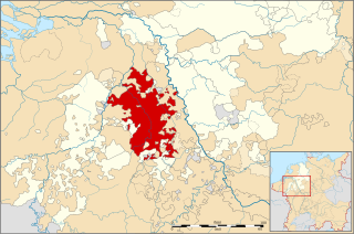
| Beschrijving | Locator map of the Duchy of Jülich, modernday North Rhine-Westphalia, Germany |
| Datum | |
| Bron | File:Locator Principality of Stavelot-Malmedy (1560).svg |
| Auteur | ZH2000 |
| Toestemming (Hergebruik van dit bestand) |
Dit bestand is gelicenseerd onder de Creative Commons-licentie Naamsvermelding-Gelijk delen 3.0 Unported
|
| Andere versies |
|
.svg)
.svg)
.svg)
.svg)
.svg)
.svg)
.svg)
.svg)
Bestandsgeschiedenis
Klik op een datum/tijd om het bestand te zien zoals het destijds was.
| Datum/tijd | Miniatuur | Afmetingen | Gebruiker | Opmerking | |
|---|---|---|---|---|---|
| huidige versie | 30 dec 2013 00:14 | | 5.029 × 3.330 (570 kB) | Hans Erren | added Eygelshoven |
| 28 apr 2011 17:58 |  | 5.029 × 3.330 (575 kB) | ZH2010 | {{Information |Description= Locator map of the Duchy of Jülich, modernday North Rhine-Westphalia, Germany |Source= File:Locator Principality of Stavelot-Malmedy (1560).svg |Date=2010-04-28 |Author= ZH2000 |Permission={{cc-by-sa-3.0}} |other_ve |
.svg)
Bestandsgebruik
Dit bestand wordt op de volgende pagina gebruikt:
Globaal bestandsgebruik
De volgende andere wiki's gebruiken dit bestand:
- Gebruikt op ar.wikipedia.org
- Gebruikt op be.wikipedia.org
- Gebruikt op bg.wikipedia.org
- Gebruikt op ca.wikipedia.org
- Gebruikt op cs.wikipedia.org
- Gebruikt op de.wikipedia.org
- Gebruikt op el.wikipedia.org
- Gebruikt op en.wikipedia.org
- Gebruikt op eo.wikipedia.org
- Gebruikt op es.wikipedia.org
- Gebruikt op et.wikipedia.org
- Gebruikt op he.wikipedia.org
- Gebruikt op id.wikipedia.org
- Gebruikt op it.wikipedia.org
- Gebruikt op ja.wikipedia.org
- Gebruikt op li.wikipedia.org
- Gebruikt op ro.wikipedia.org
- Gebruikt op ru.wikipedia.org
- Gebruikt op vi.wikipedia.org
- Gebruikt op www.wikidata.org
- Gebruikt op zh.wikipedia.org
.svg)