
Bestand:Louisiana - Poverty Point - Karte (English version).png
Grootte van deze voorvertoning: 411 × 600 pixels. Andere resoluties: 164 × 240 pixels | 329 × 480 pixels | 526 × 768 pixels | 1.178 × 1.719 pixels.
Oorspronkelijk bestand (1.178 × 1.719 pixels, bestandsgrootte: 762 kB, MIME-type: image/png)
| Dit is een bestand van Wikimedia Commons. Onderstaande beschrijving komt van de beschrijving van het bestand daar. |
| Beschrijving |
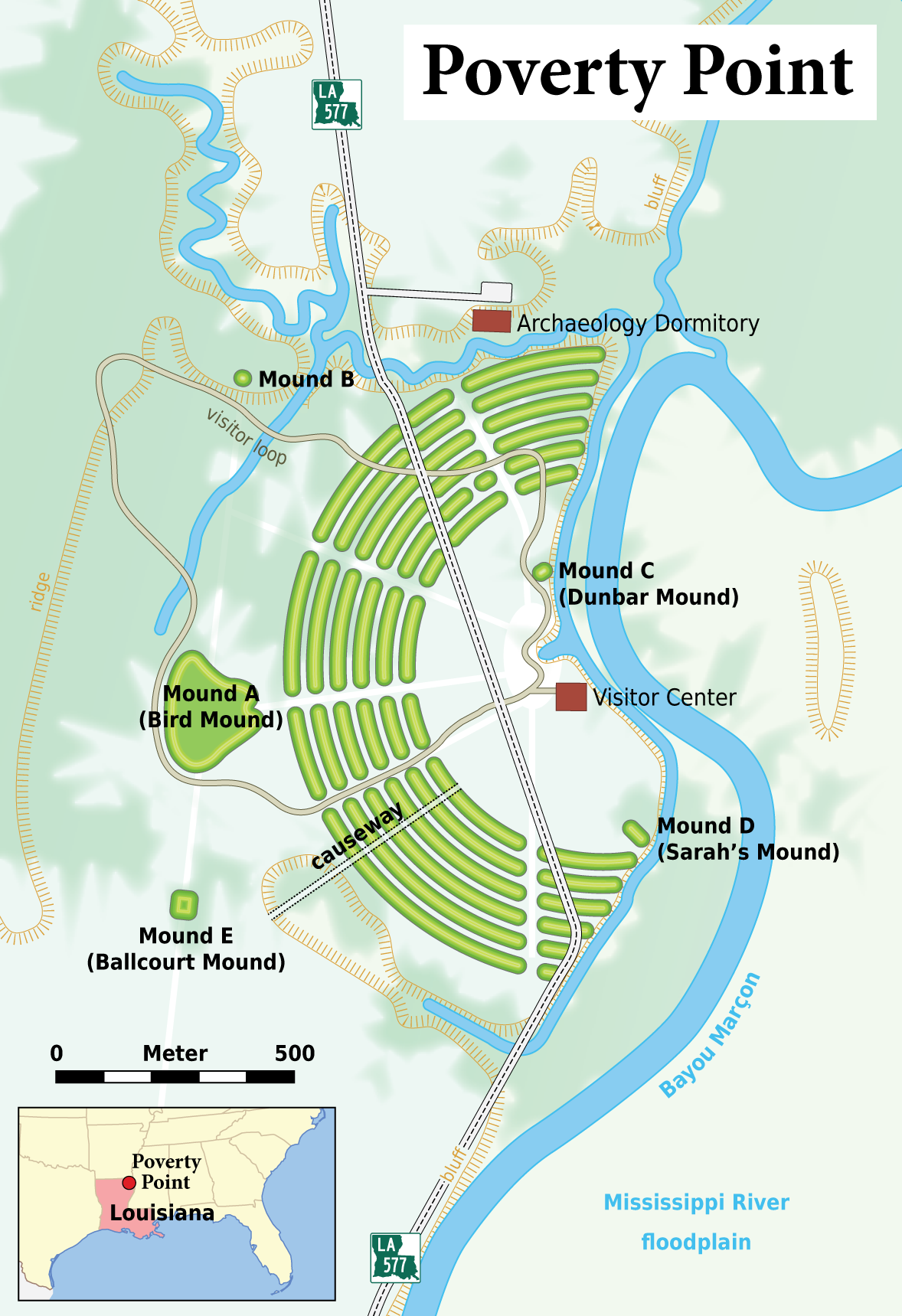
Deutsch: Karte: Übersicht über die archäologische Stätte von Poverty Point (Louisiana)
English: Map of the Poverty Point archaeological site |
|
| Datum | ||
| Bron |
Self made, using the following files: The map contents are based on the follwowing informations:
Many thanks to h-stt who provided me with all these links!
|
|
| Auteur | Maximilian Dörrbecker (Chumwa) | |
| Toestemming (Hergebruik van dit bestand) |
Ik, de auteursrechthebbende van dit werk, maak het hierbij onder de volgende licentie beschikbaar: Dit bestand is gelicenseerd onder de Creative Commons-licentie Naamsvermelding-Gelijk delen 2.5 Unported
Sie dürfen das Bild zu den folgenden Bedingungen nutzen:
|
|
| Andere versies |

.png)
.png)

.png)
Bestandsgeschiedenis
Klik op een datum/tijd om het bestand te zien zoals het destijds was.
| Datum/tijd | Miniatuur | Afmetingen | Gebruiker | Opmerking | |
|---|---|---|---|---|---|
| huidige versie | 13 apr 2008 19:45 | | 1.178 × 1.719 (762 kB) | Chumwa | Bayou Maçon -> Bayou Marçon |
| 13 apr 2008 18:17 |  | 1.178 × 1.719 (760 kB) | Chumwa | {{Information |Description= *{{ de }} Karte: Übersicht über die archäologische Stätte von Poverty Point (Louisiana) *{{ en }} Map of the Poverty Point archaeological site |Source=Self made, using the following files: *[[:Image:Map_of_USA_LA.svg|orient |
Bestandsgebruik
Dit bestand wordt op de volgende 2 pagina's gebruikt:
Globaal bestandsgebruik
De volgende andere wiki's gebruiken dit bestand:
- Gebruikt op ca.wikipedia.org
- Gebruikt op de.wikipedia.org
- Gebruikt op en.wikipedia.org
- Gebruikt op es.wikipedia.org
- Gebruikt op fr.wikipedia.org
- Gebruikt op he.wikipedia.org
- Gebruikt op hr.wikipedia.org
- Gebruikt op ja.wikipedia.org
- Gebruikt op ka.wikipedia.org
- Gebruikt op pl.wikipedia.org
- Gebruikt op tr.wikipedia.org
- Gebruikt op vi.wikipedia.org
.png)