
Bestand:Louisiana parishes map.png

Grootte van deze voorvertoning: 651 × 600 pixels. Andere resoluties: 261 × 240 pixels | 521 × 480 pixels | 865 × 797 pixels.
Oorspronkelijk bestand (865 × 797 pixels, bestandsgrootte: 144 kB, MIME-type: image/png)
| Dit is een bestand van Wikimedia Commons. Onderstaande beschrijving komt van de beschrijving van het bestand daar. |
Beschrijving
| Beschrijving |
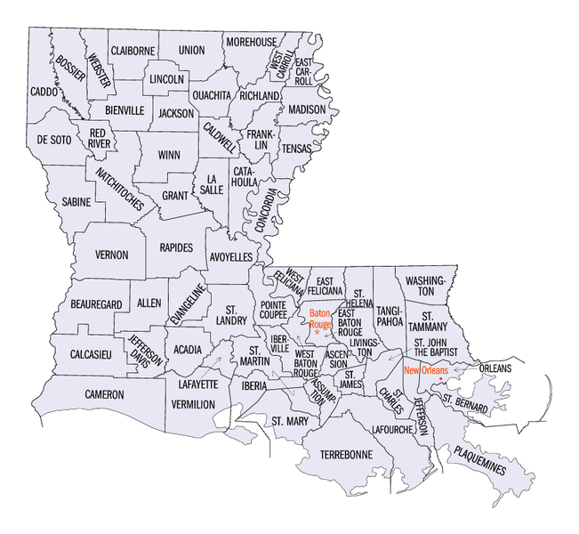
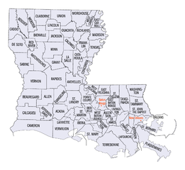
English: Map of Louisiana parishes. |
| Bron | |
| Auteur | United States Census Bureau |
| Andere versies |
Same map with labels enlarged, including darker labels for parishes of New Orleans: |
Licentie
This image or file is a work of a United States Census Bureau employee, taken or made as part of that person's official duties. As a work of the U.S. federal government, the image is in the public domain.
|
 |
Oorspronkelijk uploadlogboek
De oorspronkelijke beschrijving van deze afbeelding stond hier. Alle volgende gebruikersnamen verwijzen naar en.wikipedia.
- 2005-06-24 22:45 Jengod 865×797× (147111 bytes) {{PD-USGov-DOC-Census}} [[Category:Louisiana maps]]
Bestandsgeschiedenis
Klik op een datum/tijd om het bestand te zien zoals het destijds was.
| Datum/tijd | Miniatuur | Afmetingen | Gebruiker | Opmerking | |
|---|---|---|---|---|---|
| huidige versie | 14 jul 2006 15:27 | | 865 × 797 (144 kB) | JosN | Map of Louisiana parishes Used in English wikipedia category:Maps of Louisiana |
Bestandsgebruik
Dit bestand wordt op de volgende pagina gebruikt:
Globaal bestandsgebruik
De volgende andere wiki's gebruiken dit bestand:
- Gebruikt op en.wikipedia.org
- Gebruikt op eo.wikipedia.org
- Gebruikt op es.wikipedia.org
- Gebruikt op hu.wikipedia.org
- Gebruikt op it.wikipedia.org
- Gebruikt op ja.wikipedia.org
- Gebruikt op ko.wikipedia.org
- Gebruikt op nds.wikipedia.org
- Gebruikt op pl.wikipedia.org
- Gebruikt op ro.wikipedia.org
- Gebruikt op sv.wikipedia.org