
Bestand:Luton UK locator map.svg

Afmetingen van deze voorvertoning van het type PNG van dit SVG-bestand: 530 × 599 pixels Andere resoluties: 212 × 240 pixels | 425 × 480 pixels | 679 × 768 pixels | 906 × 1.024 pixels | 1.812 × 2.048 pixels | 1.120 × 1.266 pixels.
Oorspronkelijk bestand (SVG-bestand, nominaal 1.120 × 1.266 pixels, bestandsgrootte: 675 kB)
Dit is een bestand van Wikimedia Commons.
Onderstaande beschrijving komt van de beschrijving van het bestand daar.
Onderstaande beschrijving komt van de beschrijving van het bestand daar.
| Beschrijving |
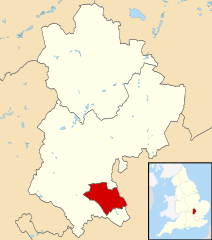
Map of Bedfordshire, UK with Luton highlighted. Equirectangular map projection on WGS 84 datum, with N/S stretched 160% |
| Datum | |
| Bron |
|
| Auteur | Nilfanion, created using Ordnance Survey data |
| Toestemming (Hergebruik van dit bestand) |
Dit bestand is gelicenseerd onder de Creative Commons-licentie Naamsvermelding-Gelijk delen 3.0 Unported Naamsvermelding: Contains Ordnance Survey data © Crown copyright and database right
|
Bestandsgeschiedenis
Klik op een datum/tijd om het bestand te zien zoals het destijds was.
| Datum/tijd | Miniatuur | Afmetingen | Gebruiker | Opmerking | |
|---|---|---|---|---|---|
| huidige versie | 4 aug 2011 00:43 | | 1.120 × 1.266 (675 kB) | Nilfanion | {{Information |Description=Map of Bedfordshire, UK with Luton highlighted. Equirectangular map projection on WGS 84 datum, with N/S stretched 160% |Source=Ordnance Survey [https://www.ordnancesurvey.co |
Bestandsgebruik
Dit bestand wordt op de volgende pagina gebruikt:
Globaal bestandsgebruik
De volgende andere wiki's gebruiken dit bestand:
- Gebruikt op azb.wikipedia.org
- Gebruikt op bn.wikipedia.org
- Gebruikt op cy.wikipedia.org
- Gebruikt op en.wikipedia.org
- Gebruikt op fa.wikipedia.org
- Gebruikt op fi.wikipedia.org
- Gebruikt op frr.wikipedia.org
- Gebruikt op hy.wikipedia.org
- Gebruikt op ja.wikipedia.org
- Gebruikt op lv.wikipedia.org
- Gebruikt op mk.wikipedia.org
- Gebruikt op ms.wikipedia.org
- Gebruikt op no.wikipedia.org
- Gebruikt op pl.wikivoyage.org
- Gebruikt op qu.wikipedia.org
- Gebruikt op ro.wikipedia.org
- Gebruikt op sco.wikipedia.org
- Gebruikt op sv.wikipedia.org
- Gebruikt op th.wikipedia.org
- Gebruikt op ur.wikipedia.org
- Gebruikt op yi.wikipedia.org