
Bestand:México División Política-1824.png
Grootte van deze voorvertoning: 557 × 599 pixels. Andere resoluties: 223 × 240 pixels | 446 × 480 pixels | 714 × 768 pixels | 1.098 × 1.181 pixels.
Oorspronkelijk bestand (1.098 × 1.181 pixels, bestandsgrootte: 296 kB, MIME-type: image/png)
| Dit is een bestand van Wikimedia Commons. Onderstaande beschrijving komt van de beschrijving van het bestand daar. |
| Beschrijving |
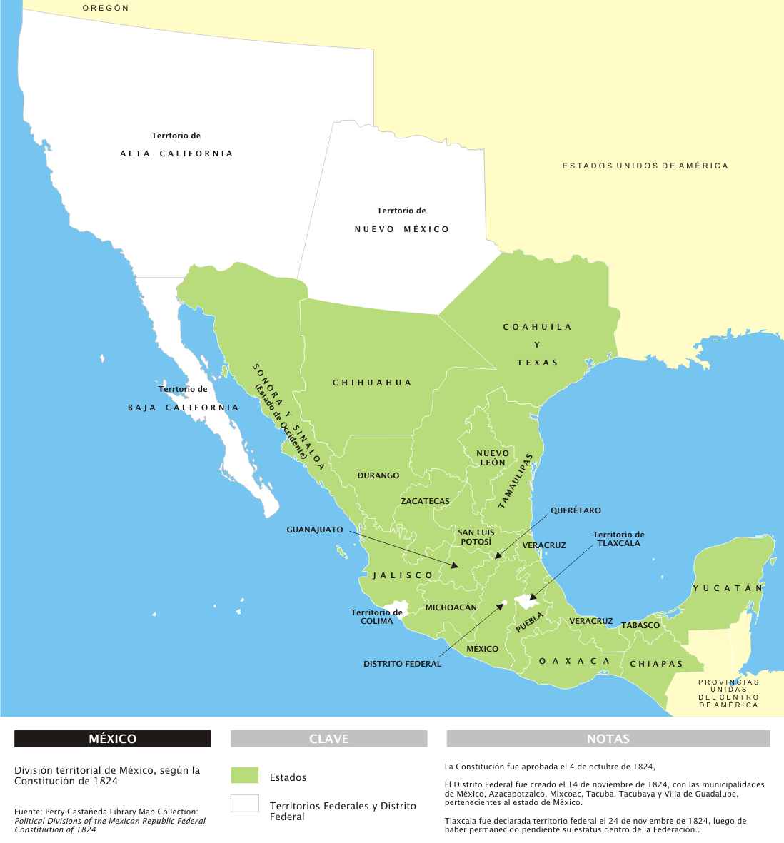
Español: División territorial de México en 1824, con notas en español. |
||
| Datum | |||
| Bron | Eigen werk | ||
| Auteur | Yavidaxiu | ||
| Toestemming (Hergebruik van dit bestand) |
|
||
| Andere versies | Afgeleide werken van dit bestand: Map of Coahuila y Texas.PNG |
Bestandsgeschiedenis
Klik op een datum/tijd om het bestand te zien zoals het destijds was.
| Datum/tijd | Miniatuur | Afmetingen | Gebruiker | Opmerking | |
|---|---|---|---|---|---|
| huidige versie | 28 mrt 2007 19:33 | | 1.098 × 1.181 (296 kB) | Yavidaxiu | {{Information |Description={{es|División territorial de México en 1824, con notas en español.}} |Source=Trabajo propio |Date=28 de marzo de 2006 |Author=Yavidaxiu |Permission={{PD-self}} |other_versions= }} Category:Maps of Mexico |
Bestandsgebruik
Dit bestand wordt op de volgende pagina gebruikt:
Globaal bestandsgebruik
De volgende andere wiki's gebruiken dit bestand:
- Gebruikt op it.wikipedia.org
- Gebruikt op no.wikipedia.org