
Bestand:Madhya Pradesh district location map Chhatarpur.svg

Afmetingen van deze voorvertoning van het type PNG van dit SVG-bestand: 530 × 599 pixels Andere resoluties: 212 × 240 pixels | 425 × 480 pixels | 680 × 768 pixels | 906 × 1.024 pixels | 1.812 × 2.048 pixels | 1.639 × 1.852 pixels.
Oorspronkelijk bestand (SVG-bestand, nominaal 1.639 × 1.852 pixels, bestandsgrootte: 744 kB)
| Dit is een bestand van Wikimedia Commons. Onderstaande beschrijving komt van de beschrijving van het bestand daar. |
| Beschrijving |
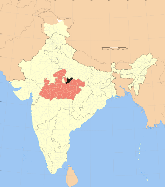
English: Map showing location of Chhatarpur district in Madhya Pradesh in India
Español: Mapa mostrando la locación del distrito de Chhatarpur en Madhya Pradesh, India. |
| Datum | |
| Bron | own work based on image:India Madhya Pradesh locator map.svg |
| Auteur | User:Haros based on map created by w:user:Nichalp & w:user:Planemad |
| Toestemming (Hergebruik van dit bestand) |
Own work, attribution required (Multi-license with GFDL and Creative Commons CC-BY 3.0) |
Ik, de auteursrechthebbende van dit werk, maak het hierbij onder de volgende licenties beschikbaar:
Dit bestand is gelicenseerd onder de Creative Commons-licentie Naamsvermelding-Gelijk delen 3.0 Unported
- De gebruiker mag:
- Delen – het werk kopiëren, verspreiden en doorgeven
- Remixen – afgeleide werken maken
- Onder de volgende voorwaarden:
- naamsvermelding – U moet op een gepaste manier aan naamsvermelding doen, een link naar de licentie geven, en aangeven of er wijzigingen in het werk zijn aangebracht. U mag dit op elke redelijke manier doen, maar niet zodanig dat de indruk wordt gewekt dat de licentiegever instemt met uw werk of uw gebruik van zijn werk.
- Gelijk delen – Als u het werk heeft geremixt, veranderd, of erop heeft voortgebouwd, moet u het gewijzigde materiaal verspreiden onder dezelfde licentie als het oorspronkelijke werk, of een daarmee compatibele licentie.

|
Toestemming wordt verleend voor het kopiëren, verspreiden en/of wijzigen van dit document onder de voorwaarden van de GNU-licentie voor vrije documentatie, versie 1.2 of enige latere versie als gepubliceerd door de Free Software Foundation; zonder Invariant Sections, zonder Front-Cover Texts, en zonder Back-Cover Texts. Een kopie van de licentie is opgenomen in de sectie GNU-licentie voor vrije documentatie. |
U mag zelf één van de licenties kiezen.
Bestandsgeschiedenis
Klik op een datum/tijd om het bestand te zien zoals het destijds was.
| Datum/tijd | Miniatuur | Afmetingen | Gebruiker | Opmerking | |
|---|---|---|---|---|---|
| huidige versie | 27 okt 2008 22:59 | | 1.639 × 1.852 (744 kB) | Haros | {{Information |Description=Map showing location of district in Madhya Pradesh in India |Source=own work based on image:India Madhya Pradesh locator map.svg |Date=2008-10-27 |Author=User:Haros based on map created by w:user:Nichalp & [[w:user: |
Bestandsgebruik
Geen enkele pagina gebruikt dit bestand.
Globaal bestandsgebruik
De volgende andere wiki's gebruiken dit bestand:
- Gebruikt op ar.wikipedia.org
- Gebruikt op arz.wikipedia.org
- Gebruikt op ceb.wikipedia.org
- Gebruikt op es.wikipedia.org
- Gebruikt op eu.wikipedia.org
- Gebruikt op fr.wikipedia.org
- Gebruikt op no.wikipedia.org
- Gebruikt op ru.wikipedia.org
- Gebruikt op sat.wikipedia.org
- Gebruikt op vi.wikipedia.org
- Gebruikt op www.wikidata.org