
Bestand:Map CZ - district Pribram.PNG

Grootte van deze voorvertoning: 800 × 548 pixels. Andere resoluties: 320 × 219 pixels | 640 × 439 pixels | 1.024 × 702 pixels | 1.281 × 878 pixels.
Oorspronkelijk bestand (1.281 × 878 pixels, bestandsgrootte: 37 kB, MIME-type: image/png)
| Dit is een bestand van Wikimedia Commons. Onderstaande beschrijving komt van de beschrijving van het bestand daar. |
Beschrijving
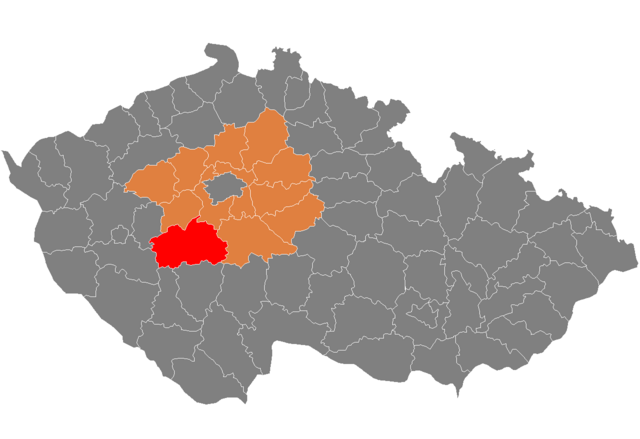
| Beschrijving | Location of Příbram District in Central Bohemian Region and the Czech Republic. |
| Datum | Datum onbekend |
| Bron | self-made, based on Image:Czech_Republic_districts.png |
| Auteur | Michiel1972 |
Licentie
| Ik, de auteursrechthebbende van dit werk, geef dit werk vrij in het publieke domein. Dit is wereldwijd van toepassing. In sommige landen is dit wettelijk niet mogelijk; in die gevallen geldt: Ik sta iedereen toe dit werk voor eender welk doel te gebruiken, zonder enige voorwaarden, tenzij zulke voorwaarden door de wet worden voorgeschreven. |
Bestandsgeschiedenis
Klik op een datum/tijd om het bestand te zien zoals het destijds was.
| Datum/tijd | Miniatuur | Afmetingen | Gebruiker | Opmerking | |
|---|---|---|---|---|---|
| huidige versie | 5 okt 2007 11:11 | | 1.281 × 878 (37 kB) | Michiel1972 | {{Information |Description=Locator_maps_of_districts_of_the_Czech_Republic. |Source=self-made, based on Image:Czech_Republic_districts.png |Date= |Author= Michiel1972 }} [[category:Locator_maps_of_districts_of_the_Czech_Republic |
Bestandsgebruik
Dit bestand wordt op de volgende pagina gebruikt:
Globaal bestandsgebruik
De volgende andere wiki's gebruiken dit bestand:
- Gebruikt op ar.wikipedia.org
- Gebruikt op azb.wikipedia.org
- Gebruikt op bg.wikipedia.org
- Gebruikt op de.wikipedia.org
- Gebruikt op en.wikipedia.org
- Gebruikt op eo.wikipedia.org
- Gebruikt op fa.wikipedia.org
- Gebruikt op fr.wikipedia.org
- Gebruikt op hu.wikipedia.org
- Gebruikt op it.wikipedia.org
- Gebruikt op ka.wikipedia.org
- Gebruikt op ms.wikipedia.org
- Gebruikt op pl.wikipedia.org
- Gebruikt op pnb.wikipedia.org
- Gebruikt op pt.wikipedia.org
- Příbram (distrito)
- Příbram
- Dobříš
- Sedlčany
- Nová Ves pod Pleší
- Predefinição:Distrito de Příbram
- Březnice (Boêmia Central)
- Nový Knín
- Rožmitál pod Třemšínem
- Sedlec-Prčice
- Jince
- Bezděkov pod Třemšínem
- Bohostice
- Bohutín (Boêmia Central)
- Borotice (Boêmia Central)
- Bratkovice
- Buková u Příbramě
- Bukovany (Příbram)
- Cetyně
- Chotilsko
- Chrást (Příbram)
- Chraštice
- Čenkov
- Čím
- Daleké Dušníky
- Dlouhá Lhota (Příbram)
- Dolní Hbity
- Drahenice
- Drahlín
- Drásov (Boêmia Central)
- Drevníky
- Drhovy
- Dubenec (Boêmia Central)
- Dublovice
- Dubno (Příbram)
- Háje
Globaal gebruik van dit bestand bekijken.