
Bestand:Map Clervaux.png
Geen hogere resolutie beschikbaar.
Map_Clervaux.png (203 × 270 pixels, bestandsgrootte: 7 kB, MIME-type: image/png)
| Dit is een bestand van Wikimedia Commons. Onderstaande beschrijving komt van de beschrijving van het bestand daar. |
Beschrijving
| Beschrijving |
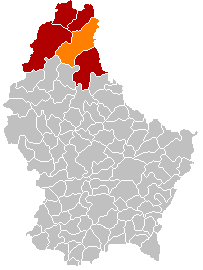
English: Clervaux municipality location after merging of municipalities (valid from 1 January 2012) |
| Datum | |
| Bron |
English: Own edit of File:Map Clervaux.PNG |
| Auteur | Les Meloures |
Licentie
| Ik, de auteursrechthebbende van dit werk, geef dit werk vrij in het publieke domein. Dit is wereldwijd van toepassing. In sommige landen is dit wettelijk niet mogelijk; in die gevallen geldt: Ik sta iedereen toe dit werk voor eender welk doel te gebruiken, zonder enige voorwaarden, tenzij zulke voorwaarden door de wet worden voorgeschreven. |
Bestandsgeschiedenis
Klik op een datum/tijd om het bestand te zien zoals het destijds was.
| Datum/tijd | Miniatuur | Afmetingen | Gebruiker | Opmerking | |
|---|---|---|---|---|---|
| huidige versie | 8 jan 2018 19:48 | | 203 × 270 (7 kB) | NordNordWest | corr |
| 8 jan 2018 19:27 |  | 203 × 270 (5 kB) | NordNordWest | upd | |
| 10 nov 2015 22:57 |  | 203 × 270 (5 kB) | NordNordWest | no more districts in Luxembourg | |
| 27 okt 2011 20:52 |  | 203 × 270 (3 kB) | Les Meloures | New map after changes in municipalities in Luxembourg | |
| 27 okt 2011 20:40 |  | 203 × 270 (3 kB) | Les Meloures | {{Information |Description ={{en|1=Location Clervaux after changes of municipalities}} |Source ={{own}} |Author =Les Meloures |Date =2011-11-24 |Permission = |other_versions = }} |
Bestandsgebruik
Dit bestand wordt op de volgende pagina gebruikt:
Globaal bestandsgebruik
De volgende andere wiki's gebruiken dit bestand:
- Gebruikt op als.wikipedia.org
- Gebruikt op ca.wikipedia.org
- Gebruikt op ceb.wikipedia.org
- Gebruikt op de.wikipedia.org
- Gebruikt op frr.wikipedia.org
- Gebruikt op fr.wikipedia.org
- Gebruikt op it.wikipedia.org
- Gebruikt op lb.wikipedia.org
- Gebruikt op li.wikipedia.org
- Gebruikt op no.wikipedia.org
- Gebruikt op simple.wikipedia.org
- Gebruikt op sk.wikipedia.org
- Gebruikt op sv.wikipedia.org
- Gebruikt op zh.wikipedia.org