
Bestand:Map of Indiana highlighting Brown County.svg

Afmetingen van deze voorvertoning van het type PNG van dit SVG-bestand: 391 × 599 pixels Andere resoluties: 156 × 240 pixels | 313 × 480 pixels | 501 × 768 pixels | 668 × 1.024 pixels | 1.337 × 2.048 pixels | 2.887 × 4.423 pixels.
Oorspronkelijk bestand (SVG-bestand, nominaal 2.887 × 4.423 pixels, bestandsgrootte: 56 kB)
| Dit is een bestand van Wikimedia Commons. Onderstaande beschrijving komt van de beschrijving van het bestand daar. |
Beschrijving
| Beschrijving |
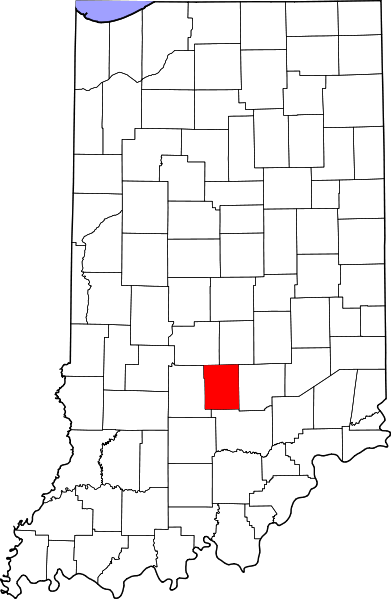
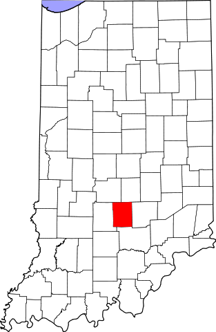
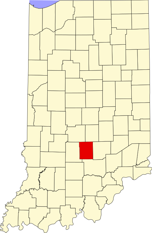
English: This is a locator map showing Brown County in Indiana. For more information, see Commons:United States county locator maps. |
| Datum | |
| Bron |
Eigen werk: English: The maps use data from nationalatlas.gov, specifically countyp020.tar.gz on the Raw Data Download page. The maps also use state outline data from statesp020.tar.gz. The Florida maps use hydrogm020.tar.gz to display Lake Okeechobee. |
| Auteur | David Benbennick |
Licentie
| Ik, de auteursrechthebbende van dit werk, geef dit werk vrij in het publieke domein. Dit is wereldwijd van toepassing. In sommige landen is dit wettelijk niet mogelijk; in die gevallen geldt: Ik sta iedereen toe dit werk voor eender welk doel te gebruiken, zonder enige voorwaarden, tenzij zulke voorwaarden door de wet worden voorgeschreven. |
Bestandsgeschiedenis
Klik op een datum/tijd om het bestand te zien zoals het destijds was.
| Datum/tijd | Miniatuur | Afmetingen | Gebruiker | Opmerking | |
|---|---|---|---|---|---|
| huidige versie | 12 feb 2006 14:09 | | 2.887 × 4.423 (56 kB) | David Benbennick | {{subst:User:Dbenbenn/clm|county=Brown County|state=Indiana}} |
Bestandsgebruik
Dit bestand wordt op de volgende pagina gebruikt:
Globaal bestandsgebruik
De volgende andere wiki's gebruiken dit bestand:
- Gebruikt op ar.wikipedia.org
- Gebruikt op azb.wikipedia.org
- Gebruikt op bg.wikipedia.org
- Gebruikt op bpy.wikipedia.org
- Gebruikt op cdo.wikipedia.org
- Gebruikt op ceb.wikipedia.org
- Gebruikt op ce.wikipedia.org
- Gebruikt op cy.wikipedia.org
- Gebruikt op de.wikipedia.org
- Gebruikt op en.wikipedia.org
- List of counties in Indiana
- Brown County, Indiana
- Nashville, Indiana
- Gnaw Bone, Indiana
- Weed Patch Hill
- Knobstone Escarpment
- Belmont, Indiana
- Beanblossom, Indiana
- Hamblen Township, Brown County, Indiana
- Jackson Township, Brown County, Indiana
- Van Buren Township, Brown County, Indiana
- Washington Township, Brown County, Indiana
- Template:Brown County, Indiana
- Template:BrownCountyIN-geo-stub
- Christiansburg, Indiana
- Cornelius, Indiana
- Elkinsville, Indiana
- Fruitdale, Indiana
- Gatesville, Indiana
- Mount Liberty, Indiana
- Needmore, Brown County, Indiana
- Pikes Peak, Indiana
- Spearsville, Indiana
- Stone Head, Indiana
- Story, Indiana
- Trevlac, Indiana
- Peoga, Indiana
Globaal gebruik van dit bestand bekijken.