
Bestand:Map of Lucas County Ohio With Municipal and Township Labels.PNG
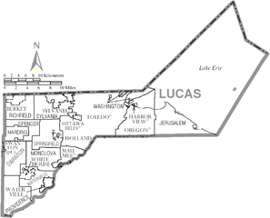
Grootte van deze voorvertoning: 742 × 600 pixels. Andere resoluties: 297 × 240 pixels | 594 × 480 pixels | 949 × 767 pixels.
Oorspronkelijk bestand (949 × 767 pixels, bestandsgrootte: 76 kB, MIME-type: image/png)
| Dit is een bestand van Wikimedia Commons. Onderstaande beschrijving komt van de beschrijving van het bestand daar. |
Beschrijving
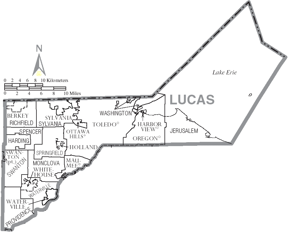
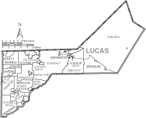
| Beschrijving | Map of Lucas County, Ohio, United States with township and municipal boundaries |
| Datum | |
| Bron | taken from US Census website [1] and modified by User:Ruhrfisch |
| Auteur | US Census, Ruhrfisch |
| Toestemming (Hergebruik van dit bestand) |
US Census / US Government work is public domain, my modifications licensed under the GNU Free Documentation License |
Licentie

|
Toestemming wordt verleend voor het kopiëren, verspreiden en/of wijzigen van dit document onder de voorwaarden van de GNU-licentie voor vrije documentatie, versie 1.2 of enige latere versie als gepubliceerd door de Free Software Foundation; zonder Invariant Sections, zonder Front-Cover Texts, en zonder Back-Cover Texts. Een kopie van de licentie is opgenomen in de sectie GNU-licentie voor vrije documentatie. |
| Dit bestand is gelicenseerd onder de Creative Commons-licentie Naamsvermelding-Gelijk delen 3.0 Unported | ||
| ||
| Deze licentietag is toegevoegd aan dit bestand in verband met de GFDL licentie-update. |
Bestandsgeschiedenis
Klik op een datum/tijd om het bestand te zien zoals het destijds was.
| Datum/tijd | Miniatuur | Afmetingen | Gebruiker | Opmerking | |
|---|---|---|---|---|---|
| huidige versie | 13 jan 2016 03:26 | | 949 × 767 (76 kB) | Elevatorrailfan | Waterville and Sylvania are cities. |
| 26 jun 2006 22:38 |  | 949 × 767 (60 kB) | Ruhrfisch | {{Information| |Description= Map of Lucas County, Ohio, United States with township and municipal boundaries |Source= taken from US Census website [http://www2.census.gov/geo/maps/general_ref/cousub_outline/cen2k_pgsz/oh_cosub.pdf] and modified by [[User |
Bestandsgebruik
Dit bestand wordt op de volgende pagina gebruikt:
Globaal bestandsgebruik
De volgende andere wiki's gebruiken dit bestand:
- Gebruikt op en.wikipedia.org
- Gebruikt op fi.wikipedia.org
- Gebruikt op ja.wikipedia.org
- Gebruikt op pt.wikipedia.org
- Gebruikt op vi.wikipedia.org
- Xã Harding, Quận Lucas, Ohio
- Xã Jerusalem, Quận Lucas, Ohio
- Xã Monclova, Quận Lucas, Ohio
- Xã Providence, Quận Lucas, Ohio
- Xã Richfield, Quận Lucas, Ohio
- Xã Spencer, Quận Lucas, Ohio
- Xã Springfield, Quận Lucas, Ohio
- Xã Swanton, Quận Lucas, Ohio
- Xã Sylvania, Quận Lucas, Ohio
- Xã Washington, Quận Lucas, Ohio
- Xã Waterville, Quận Lucas, Ohio