
Bestand:Mashonaland East districts.png
Grootte van deze voorvertoning: 776 × 600 pixels. Andere resoluties: 311 × 240 pixels | 621 × 480 pixels | 994 × 768 pixels | 1.056 × 816 pixels.
Oorspronkelijk bestand (1.056 × 816 pixels, bestandsgrootte: 39 kB, MIME-type: image/png)
| Dit is een bestand van Wikimedia Commons. Onderstaande beschrijving komt van de beschrijving van het bestand daar. |
Beschrijving
| Beschrijving |
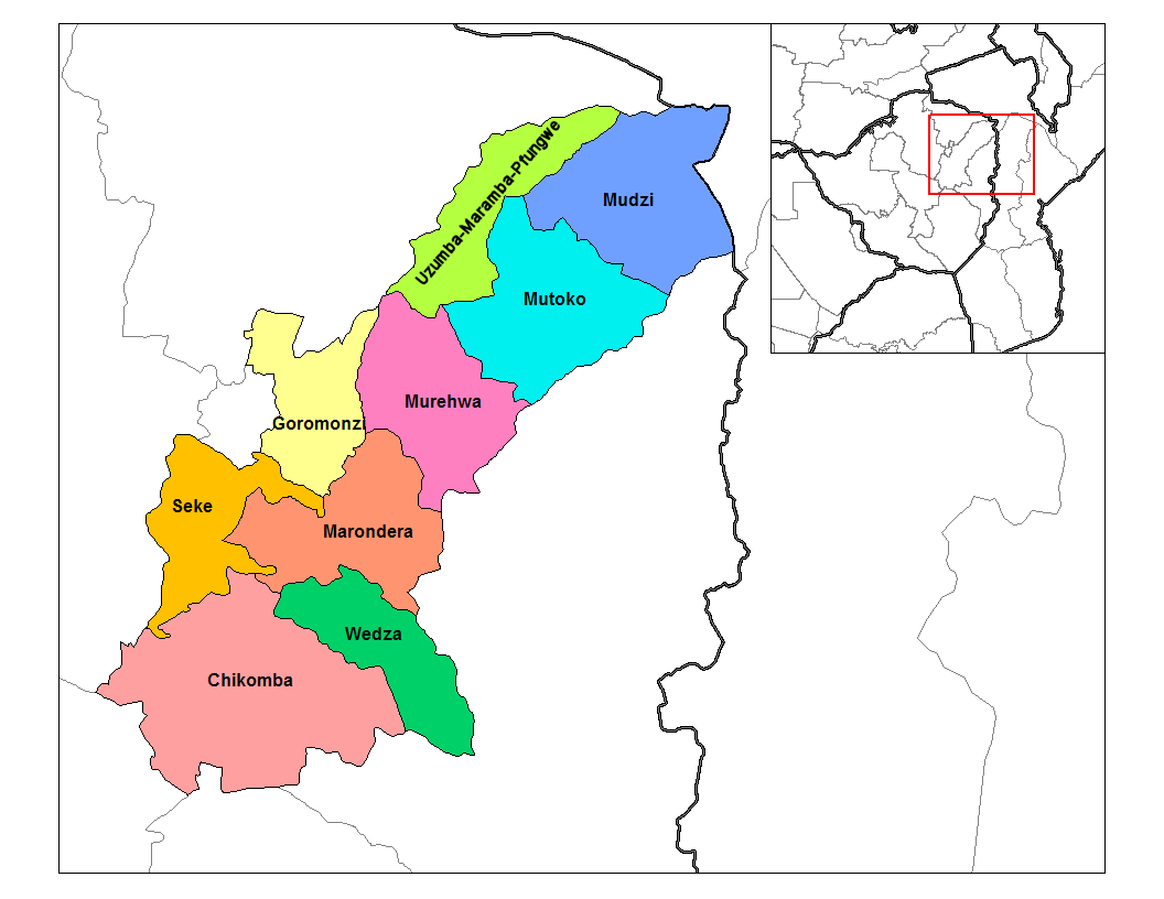
English: Map of the districts of Mashonaland East province of Zimbabwe. |
| Datum | |
| Bron |
Eigen werk (Rarelibra) using MapInfo Professional v8.5 and various mapping resources. Transferred from en.wikipedia |
| Auteur | Rarelibra at en.wikipedia |
Licentie
| Dit werk vrijgegeven in het publieke domein door de auteur, Rarelibra op de Engelstalige Wikipedia. Dit is wereldwijd van toepassing. In sommige landen is dit wettelijk niet mogelijk; in die gevallen geldt: Rarelibra staat iedereen toe dit werk voor eender welk doel te gebruiken, zonder enige voorwaarden, tenzij zulke voorwaarden door de wet worden voorgeschreven. |
Oorspronkelijk uploadlogboek
De oorspronkelijke beschrijving van deze afbeelding stond hier. Alle volgende gebruikersnamen verwijzen naar en.wikipedia.
- 2006-09-28 18:29 Rarelibra 1056×816× (34182 bytes) Map of the districts of Mashonaland East province of Angola. Created by ~~~~ for public domain use, using MapInfo Professional v8.5 and various mapping resources.
Bestandsgeschiedenis
Klik op een datum/tijd om het bestand te zien zoals het destijds was.
| Datum/tijd | Miniatuur | Afmetingen | Gebruiker | Opmerking | |
|---|---|---|---|---|---|
| huidige versie | 22 apr 2014 22:15 | | 1.056 × 816 (39 kB) | Maproom | Relabelled the northern of the two "Murehwa" districts as "Uzumba-Maramba-Pfungwe", as requested at https://en.wikipedia.org/wiki/Wikipedia:Graphics_Lab/Map_workshop on April 22nd, 2014. |
| 10 jan 2011 15:36 |  | 1.056 × 816 (33 kB) | Klik9 | {{Information |Description=Map of the districts of Mashonaland East province of Zimbabwe |Source=Originally from [http://en.wikipedia.org en.wikipedia]; description page is (was) here |Date=2006 |Author=[[Rareli |
Bestandsgebruik
Dit bestand wordt op de volgende pagina gebruikt:
Globaal bestandsgebruik
De volgende andere wiki's gebruiken dit bestand:
- Gebruikt op ca.wikipedia.org
- Gebruikt op en.wikipedia.org
- Gebruikt op es.wikipedia.org
- Gebruikt op frr.wikipedia.org
- Gebruikt op it.wikipedia.org
- Gebruikt op ja.wikipedia.org
- Gebruikt op ka.wikipedia.org
- Gebruikt op lt.wikipedia.org
- Gebruikt op mrj.wikipedia.org
- Gebruikt op pl.wikipedia.org
- Gebruikt op pt.wikipedia.org
- Gebruikt op ro.wikipedia.org
- Gebruikt op ru.wikipedia.org
- Gebruikt op sn.wikipedia.org
- Gebruikt op tr.wikipedia.org
- Gebruikt op uk.wikipedia.org
- Gebruikt op zu.wikipedia.org