
Bestand:MinasGerais Municip CorregoNovo.svg

Afmetingen van deze voorvertoning van het type PNG van dit SVG-bestand: 747 × 599 pixels Andere resoluties: 299 × 240 pixels | 598 × 480 pixels | 957 × 768 pixels | 1.276 × 1.024 pixels | 2.552 × 2.048 pixels | 2.147 × 1.723 pixels.
Oorspronkelijk bestand (SVG-bestand, nominaal 2.147 × 1.723 pixels, bestandsgrootte: 2,9 MB)
| Dit is een bestand van Wikimedia Commons. Onderstaande beschrijving komt van de beschrijving van het bestand daar. |

|
Standardization of derivative maps
Feel free to create derivations of this work, but if you want to illustrate a Wikipedia article with derivative works of this or similar maps of Brazil, please strictly follow the visual standard, nomenclature and classification already in use. All maps of Brazilian subdivisions are being adaptated or created in this way. We do not want to inhibit creativity but the pattern adopted here was presented and accepted by the Lusophone community and should be followed whenever possible. |
Beschrijving
| Beschrijving |
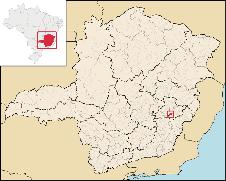
English: Location map of the municipality of Córrego Novo in Minas Gerais state, Brazil.
Português: Localização do município de Córrego Novo no estado de Minas Gerais, Brasil. |
| Datum | |
| Bron | File:Brazil Minas Gerais location map.svg (derivate for File:MinasGerais MesoMicroMunicip.svg) |
| Auteur |
Licentie
Dit bestand is gelicenseerd onder de Creative Commons-licentie Naamsvermelding 2.5 Unported
- De gebruiker mag:
- Delen – het werk kopiëren, verspreiden en doorgeven
- Remixen – afgeleide werken maken
- Onder de volgende voorwaarden:
- naamsvermelding – U moet op een gepaste manier aan naamsvermelding doen, een link naar de licentie geven, en aangeven of er wijzigingen in het werk zijn aangebracht. U mag dit op elke redelijke manier doen, maar niet zodanig dat de indruk wordt gewekt dat de licentiegever instemt met uw werk of uw gebruik van zijn werk.
Bestandsgeschiedenis
Klik op een datum/tijd om het bestand te zien zoals het destijds was.
| Datum/tijd | Miniatuur | Afmetingen | Gebruiker | Opmerking | |
|---|---|---|---|---|---|
| huidige versie | 29 jun 2020 20:22 | | 2.147 × 1.723 (2,9 MB) | Apollo BR | Feel free to create derivations of this work, but if you want to illustrate a Wikipedia article with derivative works of this or similar maps of Brazil, please strictly follow the visual standard, nomenclature and classification already in use. All maps of Brazilian subdivisions are being adaptated or created in this way. We do not want to inhibit creativity but the pattern adopted here was presented and accepted by the Lusophone community and should be followed whenever possible. |
| 31 dec 2018 19:55 |  | 914 × 709 (2,43 MB) | HVL | Removing regional division extinguished | |
| 28 aug 2006 06:53 |  | 914 × 709 (1,91 MB) | Raphael.lorenzeto | {{Information| |Description=Map locator of a city in Minas Gerais (this description will be changed) |Source=Image:MinasGerais MesoMicroMunicip.svg, own work |Date=August 28, 2006 |Author=Raphael Lorenzeto de Abreu |Permission={{self2|GFDL|cc-by-2.5} |
Bestandsgebruik
Dit bestand wordt op de volgende pagina gebruikt:
Globaal bestandsgebruik
De volgende andere wiki's gebruiken dit bestand:
- Gebruikt op ar.wikipedia.org
- Gebruikt op bpy.wikipedia.org
- Gebruikt op eo.wikipedia.org
- Gebruikt op eu.wikipedia.org
- Gebruikt op it.wikipedia.org
- Gebruikt op no.wikipedia.org
- Gebruikt op pt.wikipedia.org
- Gebruikt op ro.wikipedia.org
- Gebruikt op tt.wikipedia.org
- Gebruikt op vi.wikipedia.org
- Gebruikt op www.wikidata.org
- Gebruikt op zh-min-nan.wikipedia.org
- Gebruikt op zh.wikipedia.org